

 O-Sense
Super User
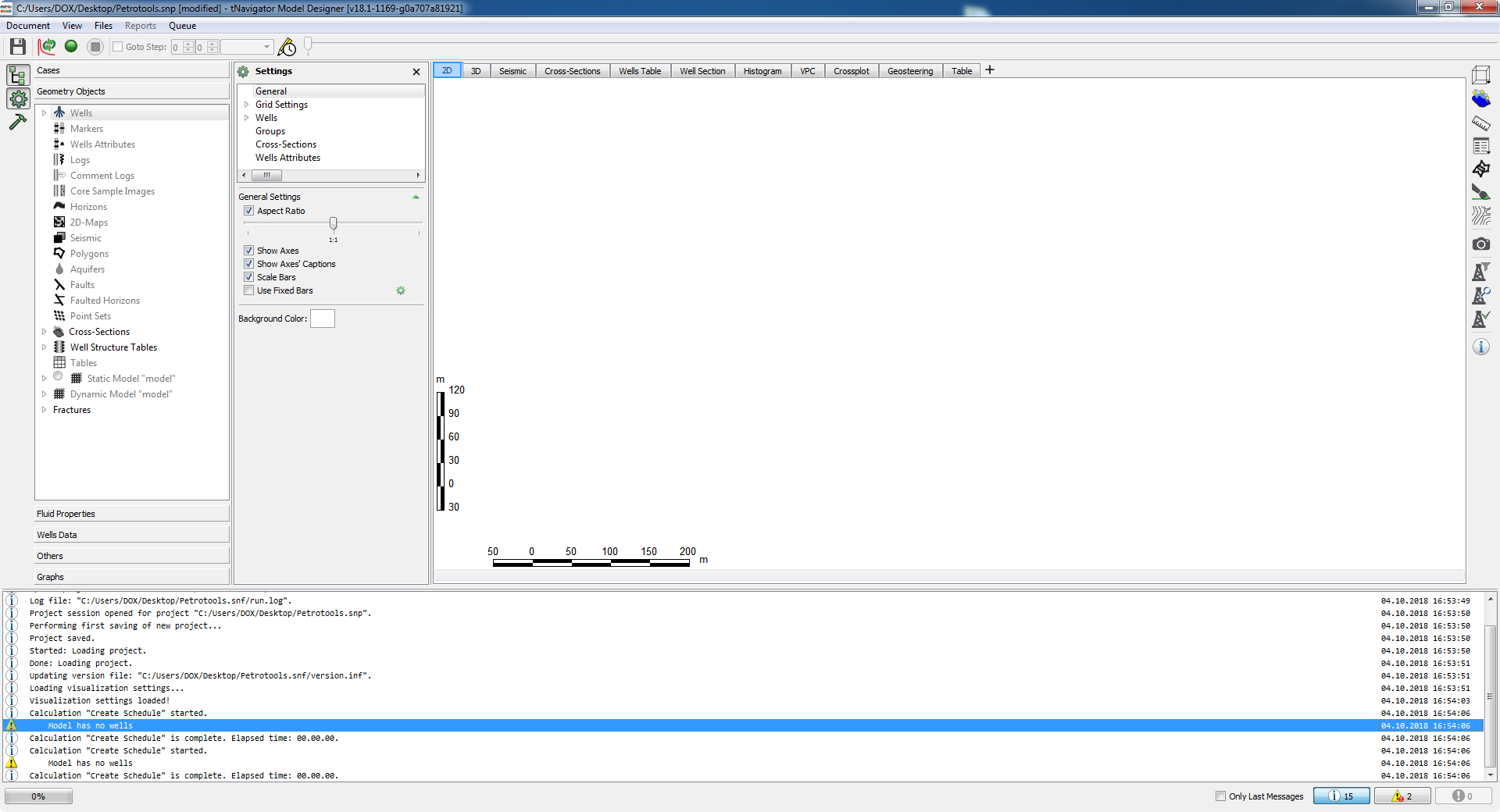
پکیج نرم افزاری tNavigator یک نرم افزار شبیه سازه مخزنی سبک است که به شکل ماژولار نوشته شده است و به شما اجازه ساخت مدل استاتیک و داینامیک، شبیه سازی مخزن و بررسی آنالیز عدم قطعیت را می دهد. این نرم افزار هم اکنون بسیار در حال رشد می باشد و به زودی به عنوان اولین نرم افزار شبیه ساز جهان خواهد بود.
بررسی نرم افزار tNavigator:

tNavigator is a software package, offered as a single executable, which allows to build static and dynamic reservoir models, run dynamic simulations, perform extended uncertainty analysis and build surface network as a part of one integrated workflow. All the parts of the workflow share common proprietary internal data storage system, superscalable parallel numerical engine, data input/output mechanism and graphical user interface. tNavigator supports METRIC, LAB, FIELD units systems.
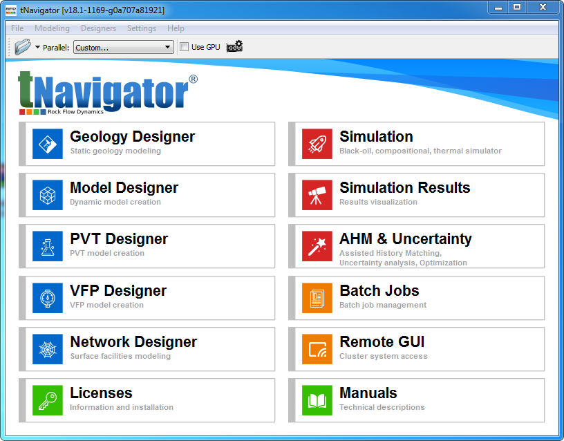
tNavigator is a multiplatform software application written in C++ and can be installed on Linux, Windows 64bit OS and run on systems with shared and distributed memory layout as a console or GUI (local or remote) based application. tNavigator runs on workstations and clusters. Cloud based solution with full GUI capabilities via remote desktop is also available. tNavigator contains the following 8 functional modules licensed separately:
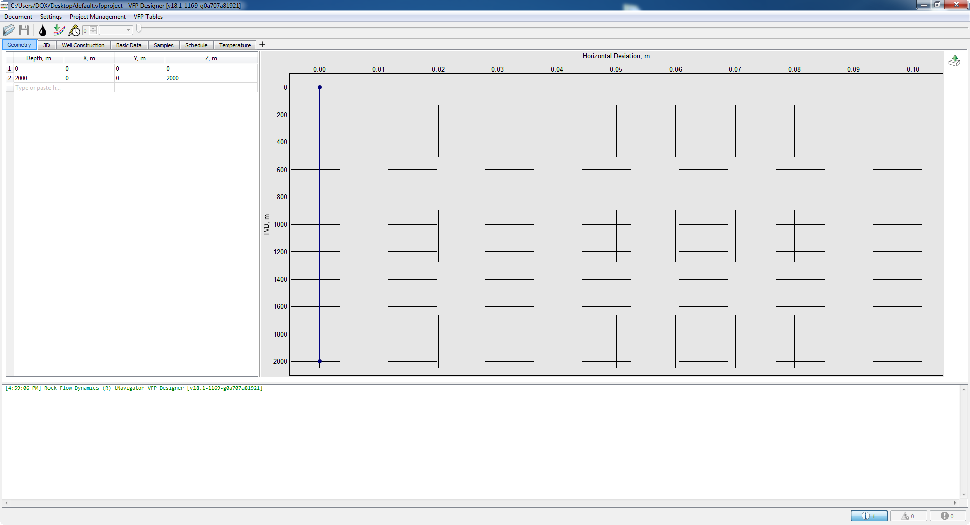
• Geology Designer (includes PVT Designer and VFP Designer)
• Model Designer (includes PVT Designer and VFP Designer)
• Network Designer (includes PVT Designer and VFP Designer)
• Black Oil simulator
• Compositional simulator
• Thermal simulator
• Assisted History Matching (AHM, optimization and uncertainty analysis)
• Graphical User Interface.
The list of tNavigator documentation is available in tNavigator Library.
physical model, mathematical model and the keywords that can be used in dynamic model in the following tNavigator modules:
• Black Oil simulator
• Compositional simulator
• Thermal simulator
For more information, please vist tNavigator website: https://rfdyn.com/tnavigator/
تیم PetroTools این نرم افزار را برای شما ارائه می دهد. جهت تهیه نرم افزار با استفاده از منوی خرید با ما در تماس باشید
For buy software, Please contact us via buy menu
![]()
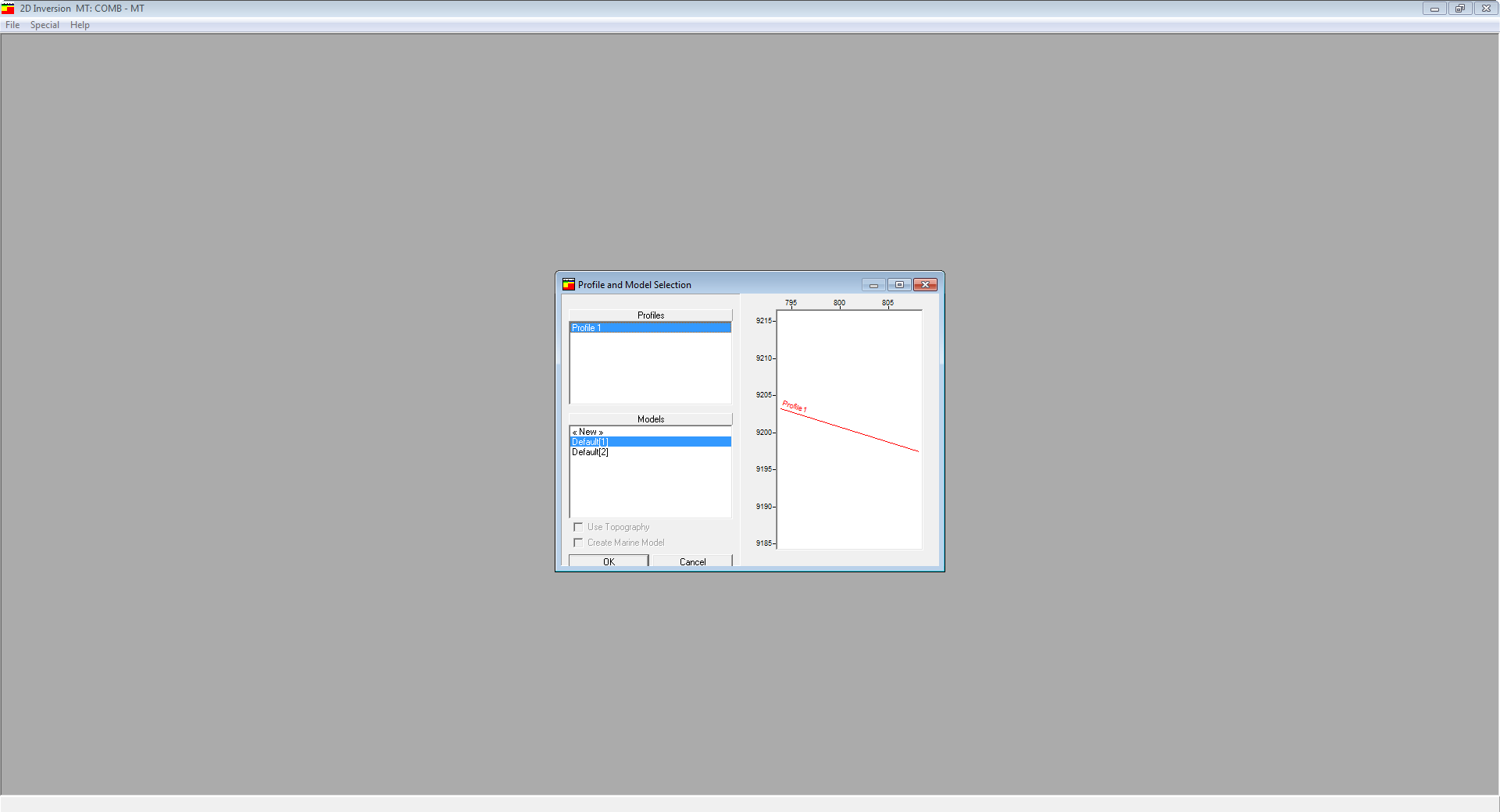
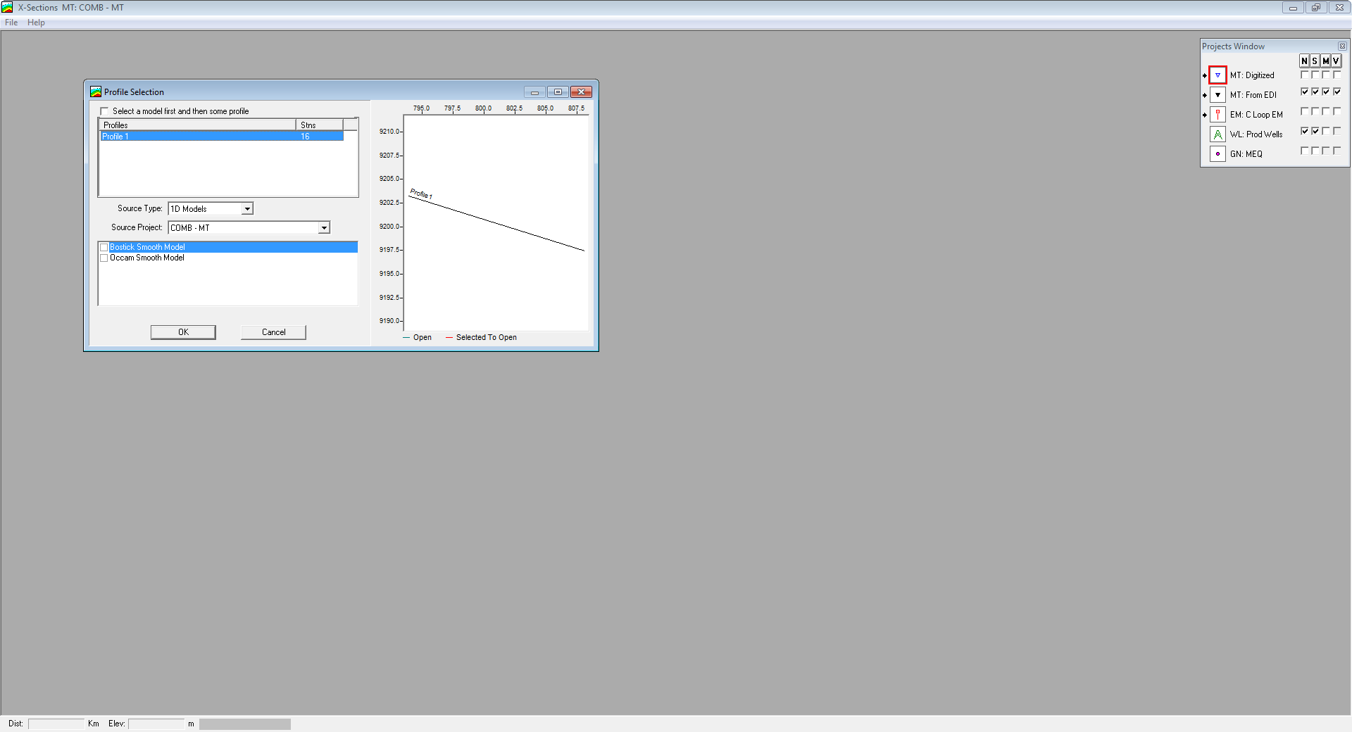
نرم افزار WinGLink یک نرم افزار مولتی دیسیپلین برای پردازش و ترکیب چندین دیسیپلین ژئوفیزیکی در یک مدل تفسیری بی همتا می باشد. این نرم افزار در گام اول بر روی اطلاعات مگنتوتلوریک (Magnetotelluric) و مدل سازیبر اساس استانداردهای جهانی فوکوس کرده است. WinGLink شامل پردازش و مدل سازی اطلاعات گراویته و مگنتیک و همچنین توانایی ارسال اطلاعات از چاه های عمودی و جهت دار بر روی نقشه و مقاطع عرضی جهت ساخت مدل ها می باشد. این نرم افزار از اینترفیسی آسان و ساده بر اساس ساخت دیتا بیس، تبدیل مختصات، دریافت خروجی و ورود اطلاعات و مدل ها و غیره تشکیل شده است.
بررسی نرم افزار WinGLink:
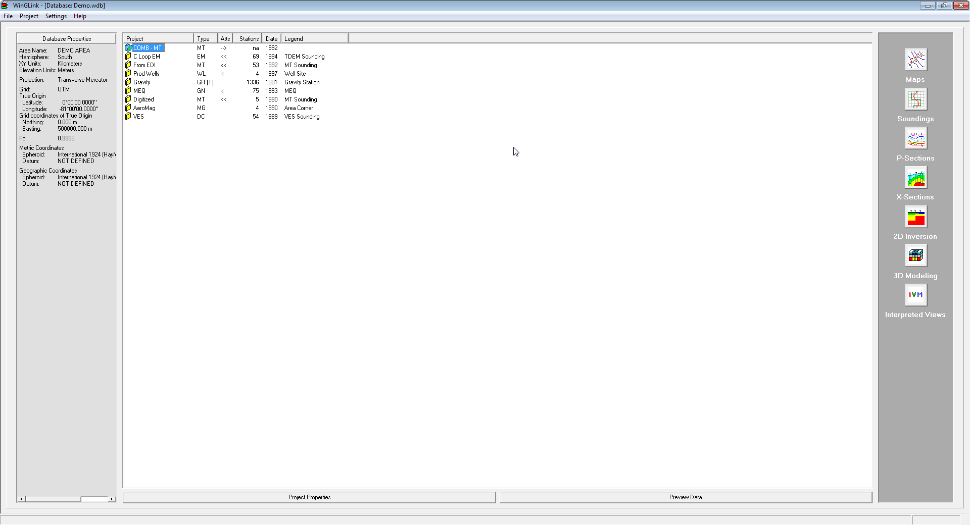
WinGLink is a multidisciplinary software program developed to process, interpret and integrate several geophysical disciplines in a unique interpretation model.
Primarily focused on Magnetotelluric data processing and modeling, for which it is the recognized worldwide standard, WinGLink includes processing and modeling applications for gravity and magnetic data, as well as the capability to post information from vertical or deviated wells on maps and cross-sections to add model constraints.
WinGLink uses a common graphic interface for database creation, project generation, coordinate conversion, data and model import/export, launch of applications. Each application includes dedicated features for each geophysical data type.
Follow the links below for details of additional WinGLink utilities.
Maps
A multidisciplinary software program developed to process, interpret and integrate several geophysical disciplines in a unique interpretation model.
Soundings
A multidisciplinary software program developed to process, interpret and integrate several geophysical disciplines in a unique interpretation model.
P-Sections
A multidisciplinary software program developed to process, interpret and integrate several geophysical disciplines in a unique interpretation model.
X-Sections
A multidisciplinary software program developed to process, interpret and integrate several geophysical disciplines in a unique interpretation model.
2D Inversion
A multidisciplinary software program developed to process, interpret and integrate several geophysical disciplines in a unique interpretation model.
3D Modeling
A multidisciplinary software program developed to process, interpret and integrate several geophysical disciplines in a unique interpretation model.
Interpreted Views
A multidisciplinary software program developed to process, interpret and integrate several geophysical disciplines in a unique interpretation model.
Tools
A multidisciplinary software program developed to process, interpret and integrate several geophysical disciplines in a unique interpretation model.
A WinGLink license supports diverse geophysical disciplines in an integrated modular package.
تیم PetroTools این نرم افزار را برای شما ارائه می دهد. جهت تهیه نرم افزار با استفاده از منوی خرید با ما در تماس باشید
For buy software, Please contact us via buy menu
![]()
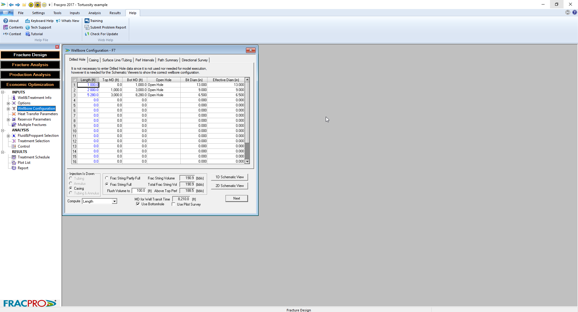
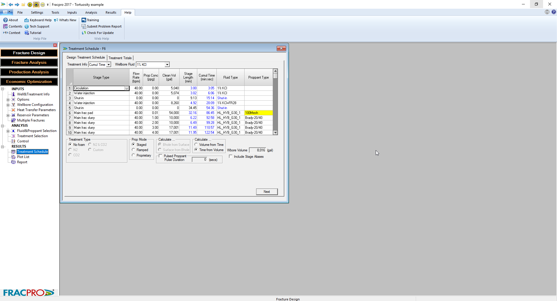
نرم افزارFracProعملکرد شما را با دادن دانش لازم برای دستیابی به شبیه سازی موفق از چاه ها بهبود می بخشد. صرف نظر از نوع تشکیل، نفوذپذیری یا مکان، با استفاده از نرم افزارFracProمی تواند به نتایج بهتر منجر شود. این نرم افزار به طور موثر می تواند هر نوع شبیه سازی فشار، از جمله چاه های ورودی محدود، چندین فواصل مشبک شده و فرکینگ در چاه های افقی را مدل کند. این نرم افزار می تواند رشد شکستگی در هر سازندکربناته، ماسه سنگی و حتی زغال سنگ را مدل کند. نرم افزار FracPro یکی از معروف ترین نرم افزارهای فرکینگ می باشد.
معرفی نرم افزار FracPro:
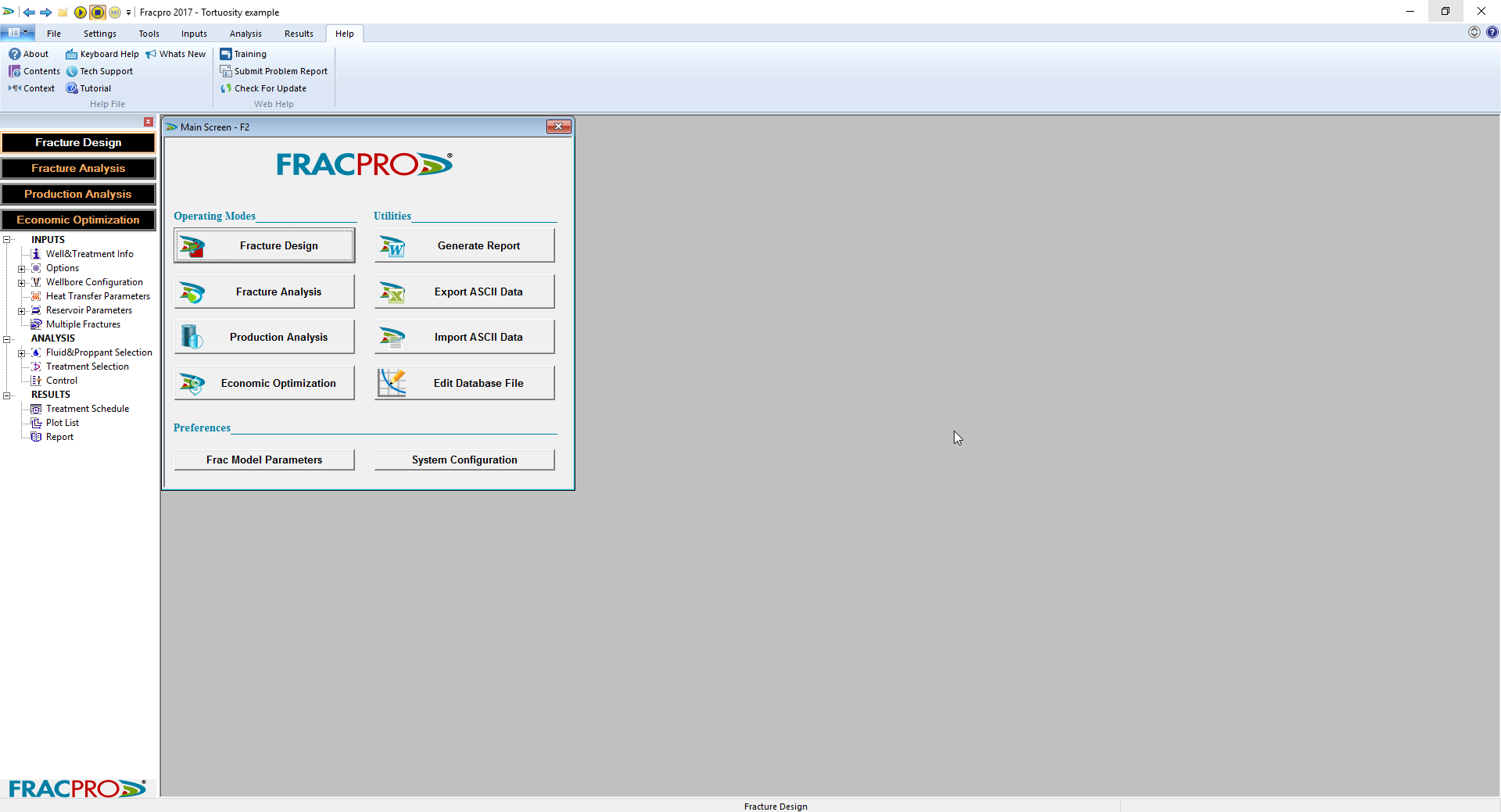
FRACPRO software improves performance from your wells by giving you the knowledge necessary to achieve successful stimulations. Regardless of formation type, permeability or location, using FRACPRO software can lead to better results.
Comprehensive modeling of any variable
The software can effectively model any type of pressure stimulation job, including limited entry wells, multiple perforated intervals and horizontal well fracturing. It can model fracture growth in any formation—carbonate, sandstone and even coal.
Gain in-depth understanding
FRACPRO software allows understanding of proppant placement, conductivity improvements and fracture dimensions. The sophisticated software has the capability to incorporate the effects of proppant damage due to crushing, embedment, stress cycling, and non-Darcy and multiphase flow.
Specialized capability for horizontal wells
The software can simulate single and multiple treatment horizontal wells, allowing creation of multiple pump schedules and reservoirs in a single file. Special displays allow you to clearly visualize fracture placement along the lateral.
Customize models with your real-time data
With FRACPRO software, you can capture fracture data in real time, allowing you to customize and calibrate models for your specific application.
Features
- Built-in libraries of fluid and proppant
- Real-time onsite monitoring and evaluation
- Supports dipping reservoirs for multiple-treatment horizontal wells
- Fully integrated analysis tools for diagnostic injections
- Reservoir properties import directly from log files
- Available in English, Chinese and Russian versions
Benefits
- Easy interface for improved first time use
- Allows customization and calibration for your specific application
- Design and display a multiple-treatment fracturing job in a single file
- Allows creation of multiple pump schedules and reservoirs in a single file
- Special displays allow for clear visualization of fracture placement along the lateral
تیم PetroTools این نرم افزار را برای شما ارائه می دهد. جهت تهیه نرم افزار با استفاده از منوی خرید با ما در تماس باشید
For buy software, Please contact us via buy menu

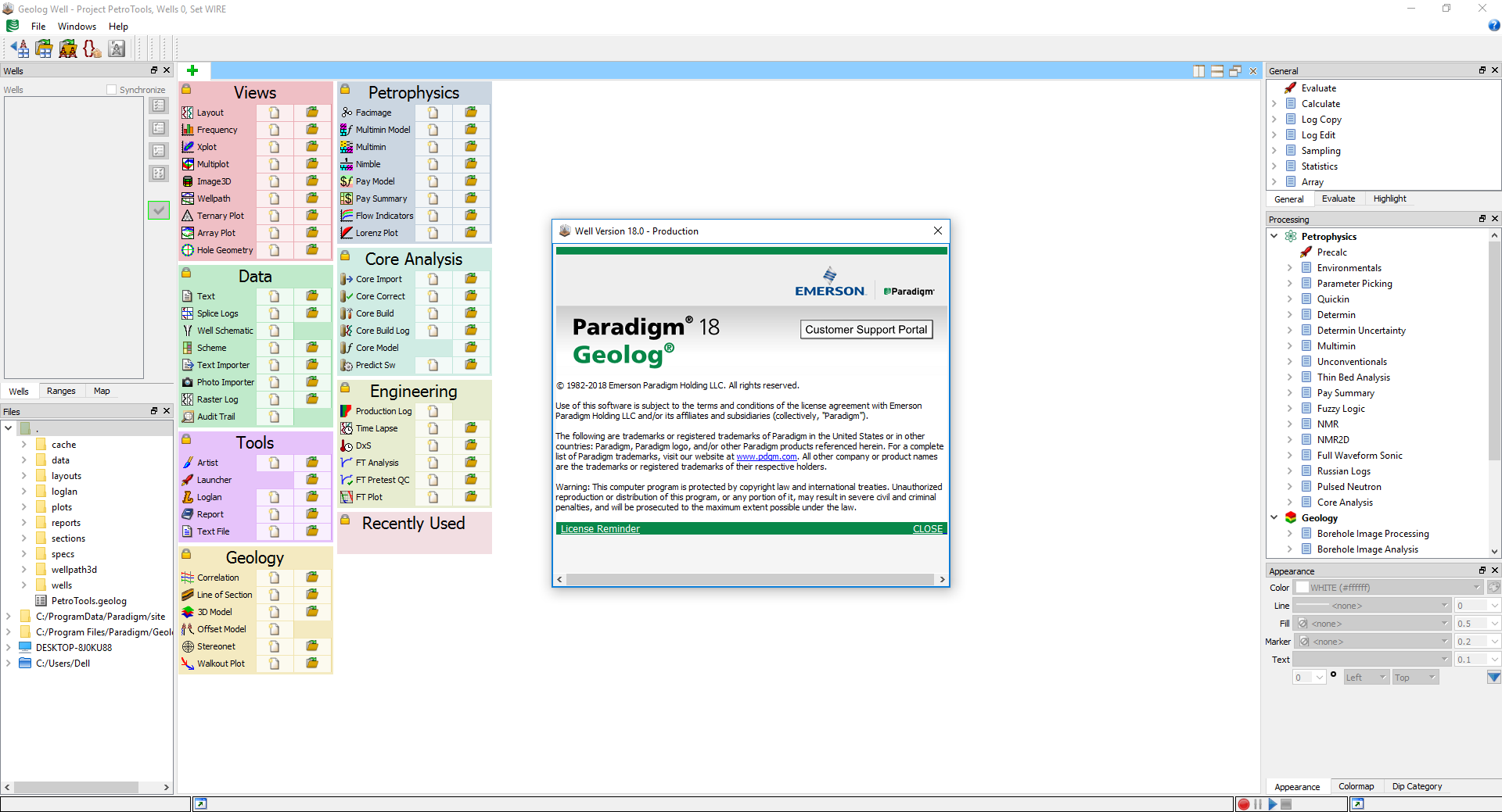
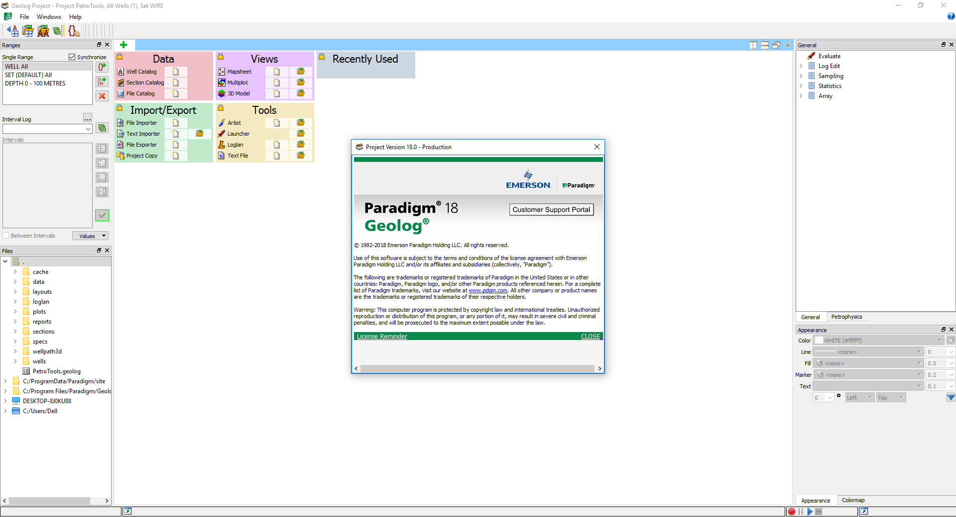
ارزیابی دقیق مخازن هم بر روی اعتبار شرکت ها و ارزش آنها و هم در تعیین ارزش اقتصادی مخازن بسیار مهم و با ارزش است. همچنین ارزیابی خواص مخزنی مخازن نقش بسیار پر رنگی در بهره برداری صحیح از مخازن و طی شدن چرخه ای سالم در زندگی میادین ایفا می کند.نرم افزار Geolog 18آخرین نسخه این نرم افزار محبوب می باشد که به همراه پکیج نرم افزار Paradigm 18عرضه شده است. Geolog 18 بخش های جدیدی برای uncertainty، گزارش گیری، متدهای جدید برای کنترل کیفیت و تفسیر دیتاهای تست فشار سازندی، آپدیت های جدید در بخش ژئومکانیک، مهندسی و بهره برداری و افزایش customization می باشد.
معرفی نرم افزار Geolog 18:
Geolog 18 is the newest version of Paradigm’s industrystandard solution for formation evaluation and petrophysical analysis. Released as part of the Paradigm™ 18 software suite, Geolog 18 offers new uncertainty capabilities, enhanced automation for reporting, new methods for Quality Control and interpretation of formation pressure test data, updates to its geomechanics, engineering and production tools, and increased customization.
Generalized uncertainty functionality
Geolog 18 includes a new uncertainty wrapper for Monte Carlo uncertainty analysis. Assessing uncertainty on calculations run through the module launcher enhances the understanding of these uncertainties, and helps quantify the value of results. Users can specify distributions for input parameters, and the module will generate a distribution of outputs. Saved calculations can be restored and re-run with the Monte Carlo mode selected. The new wrapper works both with modules supplied with Geolog and user-created custom modules, with no need for code changes in the user-created modules.
Automated report generation
Geolog 18 includes reusable, user-defined report templates containing text and graphics, that help automate repetitive reporting tasks and streamline report creation. Users can create and deploy standard reports across multiple projects and sites, for rapid delivery of consistent output. Live connection to data allows changes to be propagated to all parts of the report.
New methods for Quality Control and interpretation of formation pressure test data
Geolog 18 gives geoscientists the opportunity to rapidly load, format, interpret and perhaps most importantly, QC formation test data from all major formation test tools prior to subsequent gradient analysis. Embedded Monte Carlo uncertainty analysis enables the generation of uncertainties on formation test pressure points, on the gradients, and ultimately, on the position of fluid contacts picked using these tests. A new reporting module improves both speed and flexibility when presenting results.
Improvements to the Geolog geomechanics, engineering and production portfolio
Major updates have been made to Geolog geomechanics, engineering and production capabilities, expanding the product’s usability to multiple user communities. Anisotropic geomechanics calculations optimize prediction of well stability, while an enhanced production logging module enables Geolog to efficiently handle deviated wells. A new cement evaluation functionality is also included in this release.
Expanded customization and connectivity
Geolog has many options for customization. A new addition in Geolog 18 is the ability to create Python scripts in Geolog Loglan, with no need for compilation. Python also offers a rich set of libraries for mathematics, graphics, statistical analysis and machine learning, which can be used to further extend customization.
تیم PetroTools این نرم افزار را برای شما ارائه می دهد. جهت تهیه نرم افزار با استفاده از منوی خرید با ما در تماس باشید
For buy software, Please contact us via buy menu
![]()
موقعی که تولزی در چاه رانده می شود و یا از آن خارج می شود، خواه ابزار coiled tubing، wireline، slickline باشد و یا در حین اتصال لوله ها، از نرم افزار Cerberusاستفاده می شود. نرم افزار Cerberus به دقت نیرو های وارده بر لوله ها و خستگی لوله را تجزیه و تحلیل می کند. یکی از ویژگی های کلیدی نرم افزار، توانایی آن برای مدل سازی شرایط در حفره های افقی و افقی است.
بررسی نرم افزار Cerberus 12.7:
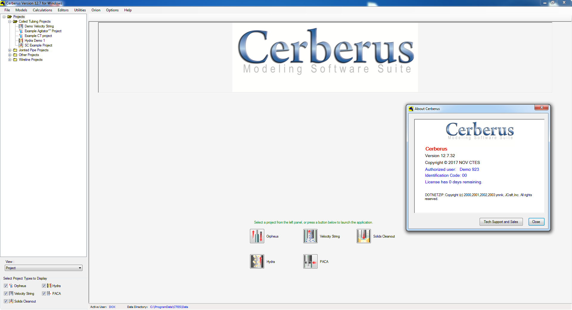
When running tools into and out of a well on coiled tubing, wireline, slickline, or jointed pipe, operations use Cerberus modeling software to accurately predict and analyze cumulative forces and coiled tubing fatigue at each stage of a job. Cerberus can determine whether the target depth can be reached, the desired tasks performed, and the equipment safely returned to surface.
A key feature of the application is its ability to model conditions in deviated and horizontal wellbores. Cerberus is the only commercial program able to model all three conveyance methods in one package, making it invaluable for choosing the best well-entry technique in marginal conditions.
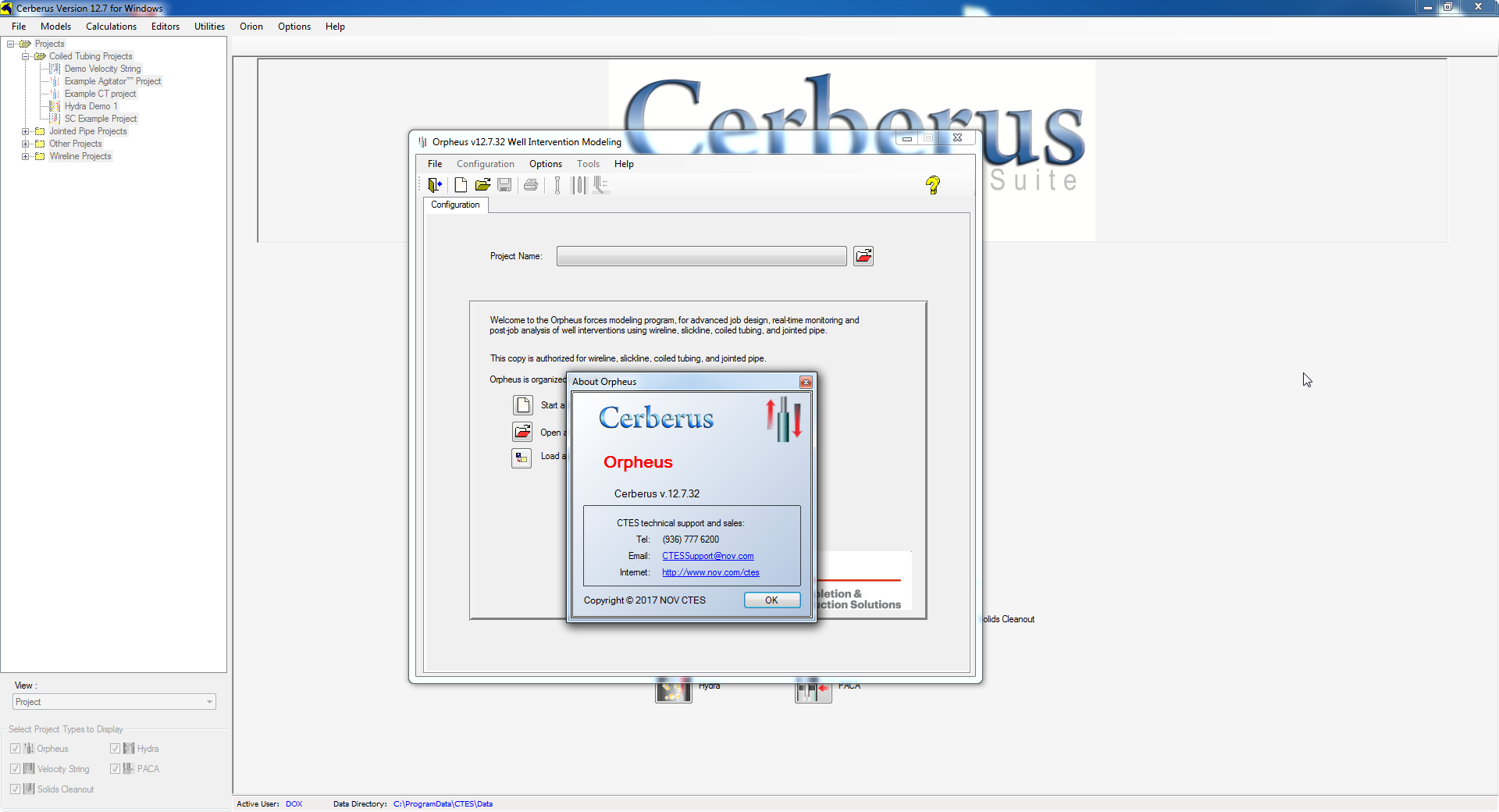
When determining the feasibility of a job, it is essential to calculate the cumulative mechanical and hydraulic forces likely to affect conveyance methods (coiled tubing, wireline, slickline, or jointed pipe). Orpheus calculates these cumulative forces, providing immediate feedback so that the user can resolve issues before they become insurmountable problems.
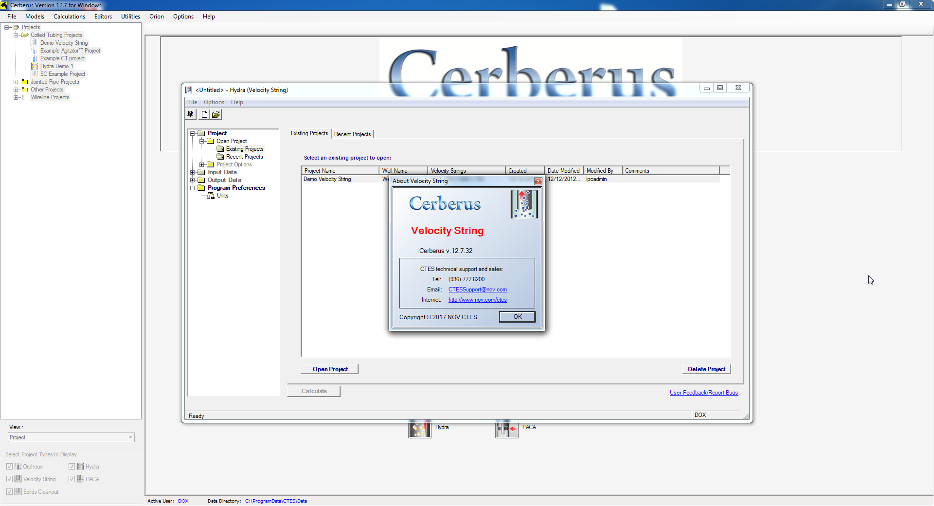
This section describes the process involved in using Velocity String, the Cerberus Hydra based model for coiled tubing and jointed pipe gas wells.
A velocity string is a small-diameter tubing string run inside the production tubing to resolve the problem of insufficient velocity available to transport liquids from the wellbore. These liquids may, in time, accumulate and impair production. Installing a velocity string reduces the flow area, thereby increasing the flow velocity, which enables liquids to be carried from the wellbore. The Velocity String model calculates the best characteristics of an intended velocity string to optimize its effectiveness in an intended application.
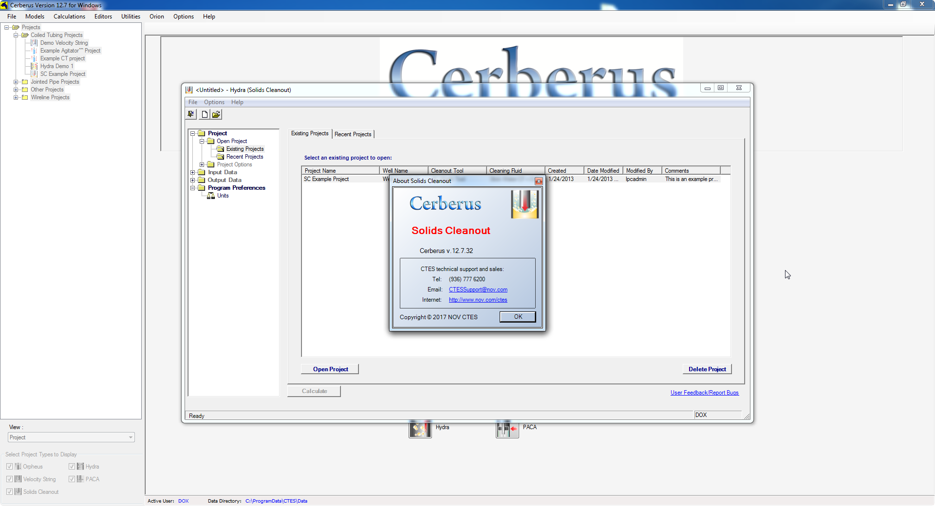
This section describes the process involved in using Solids Cleanout, the Cerberus Hydra based model for coiled tubing. Solids Cleanout calculates pump rates and the pressures involved in removing fill, such as sand, from a wellbore.
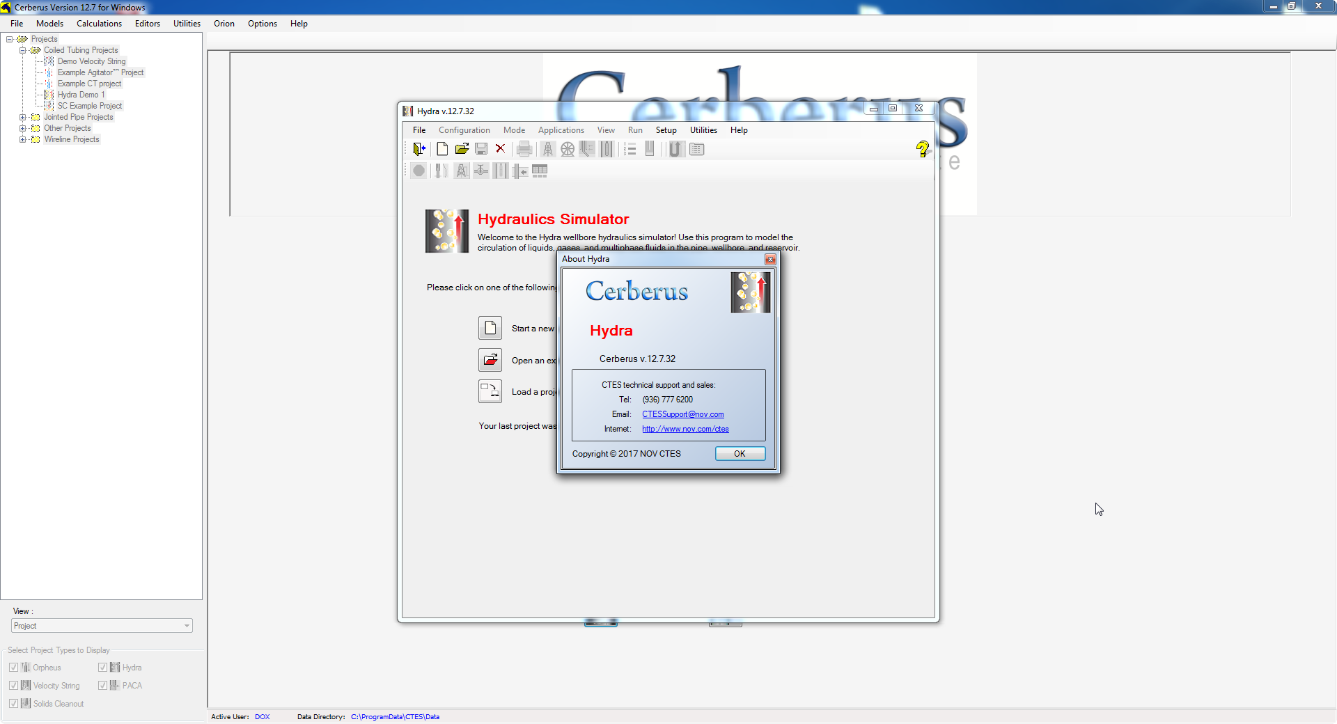
The Cerberus Hydra wellbore hydraulics simulator model performs hydraulics calculations for coiled tubing (CT) and jointed pipe (JP). Included in the model are a large number of tools to help design/model CT and JP pumping operations. Options range from basic “snapshot” calculations to more complex simulations where conditions change with time.
Hydra wizards help the user to step through the complex process of choosing fluids and specifying volumes and flow rates.
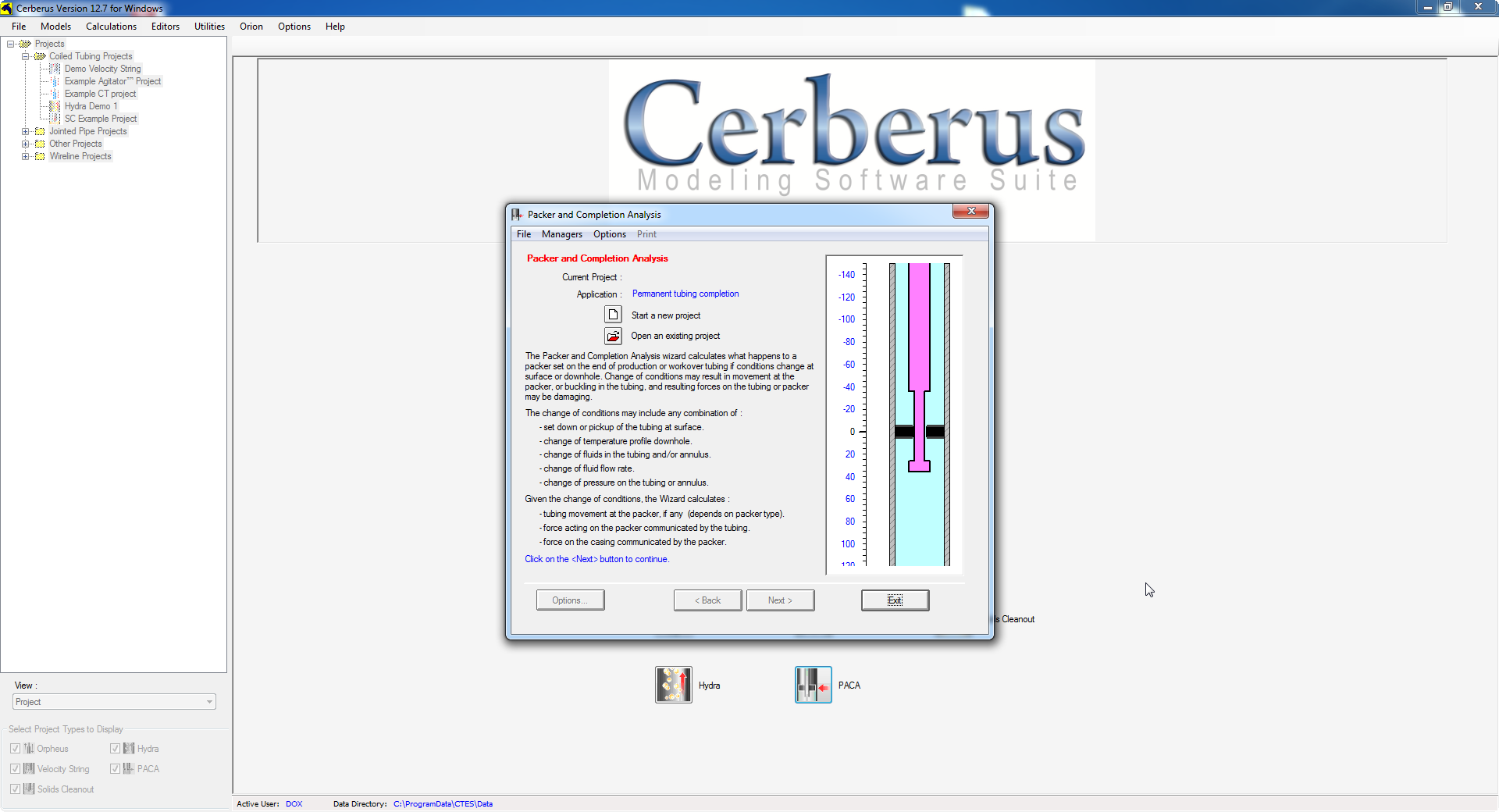
This section describes the process involved in using PACA, the Cerberus model/wizard that calculates what happens to a packer set on the end of production or workover tubing if conditions change at surface or downhole.
Change in conditions at surface or downhole may cause a packer set on the end of production or workover tubing to experience movement. Buckling in the tubing may also occur as an effect of condition change. The resulting forces on the packer or tubing may be damaging.
تیم PetroTools آخرین نسخه این نرم افزار را برای شما ارائه می دهد. جهت تهیه نرم افزار با استفاده از منوی خرید با ما در تماس باشید
For buy software, Please contact us via buy menu
![]()
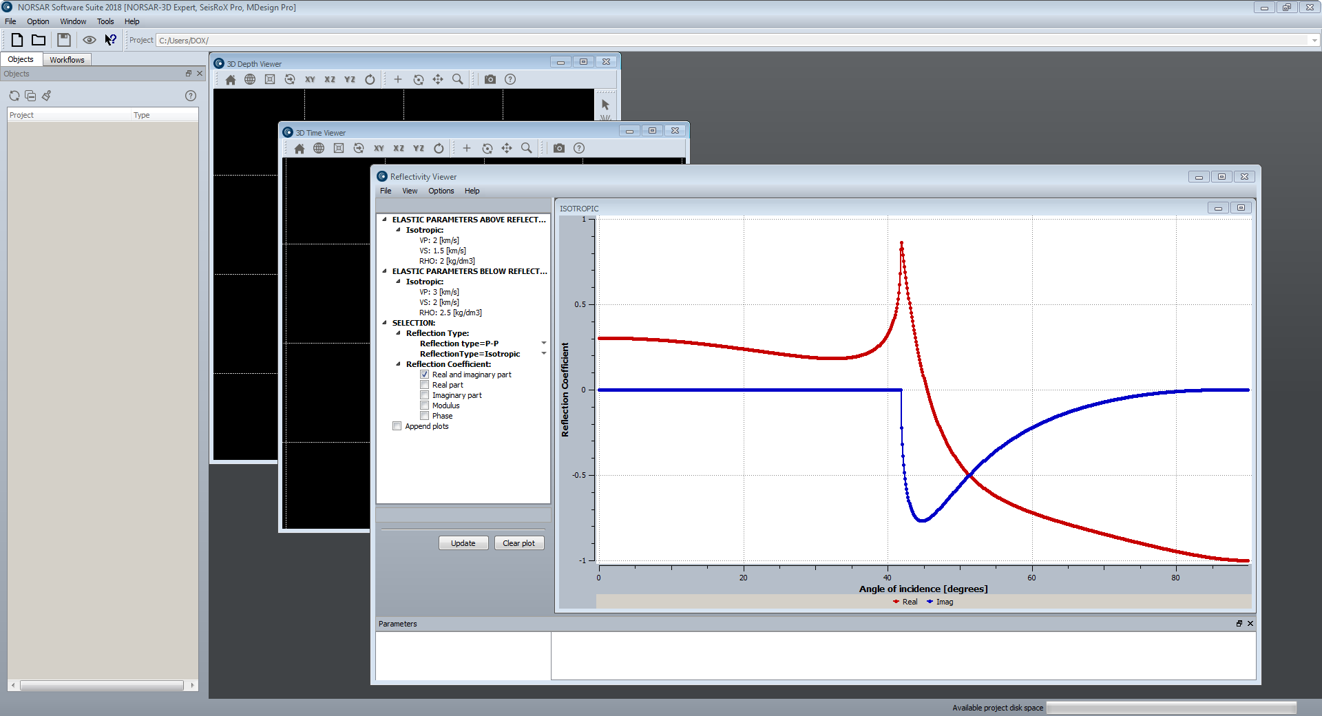
پکیج نرم افزاری NORSAR Software Suite محصول شرکت نروژی Norsar دارای ماژول های گوناگون برای مطالعات لرزه نگاری می باشد. این پکیج امکاناتی همچون Generate 3D models, Perform survey design and generation, ray modelling using the Wavefront, AVO/AVA analysis, Generate illumination maps, 3D and 2D seismic processing, full-field PSDM simulation را ارائه می دهد. این پکیچ شامل ماژول های NORSAR-3D, NORSAR-2D, SeisRoX, Mdesign می باشد.
بررسی نرم افزار Norsar Software Suite 2018:
NORSAR-3D
The new NORSAR-3D unveils a revolutionary new user interface for the NORSAR software. It makes the advanced and proven NORSAR-3D technology available in a completely new and simplified user experience.
The new NORSAR-3D is available in three different configurations: Basic, Pro and Expert. NORSAR-3D Basic is part of NORSAR-3D Pro and NORSAR-3D Pro is part of NORSAR-3D Expert. The NORSAR-3D Pro version is the upgrade version for existing customers. The new NORSAR-3D versions are backward compatible with older versions of NORSAR-3D project data.
NORSAR-3D includes functionality that enables you to:
-Import data (grid, trimesh, cube, survey, 2.5D models from N2D)
-Generate 3D models
-Perform survey design and generation
-Perform ray modelling using the Wavefront Construction method
-Generate seismograms
-Generate illumination maps (IMAP),
-Export data (grid, cube, trimesh, seismogram, illumination maps, event attributes)
NORSAR-2D
NORSAR-2D Ray-Modelling is the powerful, industry standard tool for 2D ray-trace modelling to understand seismic wave propagation.
NORSAR-2D Ray Modelling is a powerful tool to better understand your seismic data. You can evaluate your model by comparing synthetic results with the actual seismics or the interpretations. The model can be quickly updated to improve the match. Complicated tectonic structures and lateral or vertical velocity changes are modelled with great ease. NORSAR-2D includes depth conversion by means of ray tracing. Realistic interval velocities can be estimated from inversion of stacking velocities.
NORSAR-2D
-Is a powerful package for ray-based seismic modelling and depth conversion.
-Is flexible, fast, accurate and user-friendly.
-Is ideal for training, teaching, research, as well as industry-scale projects.
Some of the applications:
-Build and depth-convert 2D models.
-Plan and evaluate surveys.
-2D illumination studies.
-Ray path, event, and attribute analysis.
-AVO/AVA analysis.
-Understand reflections in seismic sections.
-Understand shadow zones in seismic sections.
-2D seismic processing support.
SeisRoX
SeisRoX is fully integrated in the NORSAR Software Suite platform and is available in two different configurations: Basic and Pro. SeisRoX Basic is part of SeisRoX Pro.
SeisRoX Basic
SeisRoX Basic is a flexible, efficient and easy-to-use seismic modelling software which rapidly simulates the seismic response of geological reservoir models including the effects of a complex 3D overburden and source-receiver illumination/resolution effects.
SeisRoX Basic focuses on a local scale and contains three types of workflows:
-Analytic workflows: Tools to do fast track modelling when background model or survey is not available or to study the effect of a user-designed PSDM filter
-Four different local-target workflows to do complete PSDM simulations with background model and survey
-Utility workflows for generating property cubes and time-convolution (1D)
SeisRoX Pro
SeisRoX Pro includes all the Basic functionality, and in addition it contains a full-field PSDM simulation workflow. With the Pro version, larger scale modelling is done by utilizing space-varying Point Spread Functions. Detailed studies of the space-varying PSF's can be done with the new PSF focusing map.
SeisRoX Pro also includes Rock Physics transformations to describe and calculate the relationship between geological properties and the effective (average) elastic and seismic properties to be used in the modelling. With the Rock Physics functionality the seismic response of rock property changes can be studied.
Simulating PSDM seismic images from reservoirs
SeisRoX™ is a software suite developed by NORSAR to efficiently model 3D PSDM (Prestack Depth Migration) seismic images at detailed reservoir scale.
Each tool can be used to provide innovative solutions to problems faced by the E&P scientist. However, the true benefit of SeisRoX is realised when the tools are integrated to provide the user with a robust, efficient and flexible workflow. In this format, the software guides the user from the generation of the rock physics model to the simulation and analysis of the 3D PSDM seismic image. This approach is particularly useful for investigating the seismic sensitivity of geological properties, seismic properties and reservoir geometry.
Capable of handling both large scale and small scale models, the effect of the overburden and survey characteristics can be incorporated while giving the user the functionality to assess the sensitivity to variations in rock properties and seismic parameters at the reservoir scale.
MDesign
The MDesign software helps operators, service providers and regulators to evaluate and optimize different sensor networks in order to maximize their cost-effectiveness.
The performance of an existing network can also be assessed and compared to results from recorded data. It is capable of using a full 3D model to provide the best possible analysis.
MDesign is applicable for both simple and complex monitoring scenarios: single or multi-well downhole networks, surface arrays, ocean bottom networks, or any combination of these.
The purpose of MDesign is performance evaluation of a proposed design. The effectiveness of a seismic network can thus be compared for different:
-Sensor distributions (short vs long string, single or multi well, downhole vs surface vs hybrid)
-Velocity models (1D or 3D)
-Noise levels (uniform or variable for each sensor)
-Sensor failure simulations (redundancy testing)
To determine the optimal sensor layout for a seismic monitoring campaign, MDesign aims to answer the following questions, important during network design:
-How cost-effective are different sensor layouts?
-What is the detection limit of a given network?
-How good are the event locations?
-Are regulatory requirements met by a given network?
-NORSAR also offers network design as a service, using our in-house expertise based on our well established network design and seismic monitoring experience.
MDesign is available as the latest NORSAR software package in the new NORSAR Software Suite framework.
Detectability
MDesign’s detectability analysis allows the user to find the minimum magnitude that can be detected for a given seismic network, throughout a model region. Multiple workflows can be created and tested for different sensor configurations. Different noise models can be generated, sensor failure can be simulated, and the effect of different input velocity models can be assessed.
For each network setup, parameters can be set for:
-Number of required sensors to be ‘triggered’
-Noise level at each sensor
-Attenuation
A 3D volume of detectability is generated that can be viewed interactively via cross-sections or isosurfaces of detectability. By analyzing maps of detectability the user can identify the network design to best meet the project goals. The detectability can also be evaluated to determine if regulatory requirements can be met. Furthermore, sensor failure and their impact on event detection can be quickly simulated.
Location uncertainty
MDesign’s location uncertainty analysis shows the variability of location precision throughout a model region. The location uncertainty is calculated for a specified event magnitude, where the detectability of the event at each sensor is considered during the computation. Similar to MDesign’s detectability analysis, multiple workflows can be created and tested for different sensor configurations, noise levels and velocity models.
The expected location uncertainty for various scenarios can be evaluated by its dependence on various parameters:
-Noise level (and SNR) at each sensor
-Errors for arrival-time picks & ray angles
-Event magnitude (i.e. triggered sensors)
The location uncertainty can be analysed via different components of uncertainty:
-Total (RMS) uncertainty
-Individual uncertainty directions (N, E, Z, minor, intermediate, major)
-“Ellipticity” (to evaluate uncertainty uniformity)
To increase understanding of the results and further improve a sensor network, MDesign allows for quick ray path analysis for all event locations through the complex model.
Focusing
MDesign’s focusing analysis shows the resolution for migration based location methodologies - typically used for dense surface arrays and ocean bottom networks. The focusing of seismic energy at a given location can be determined using Point Spread Functions, which incorporate the network layout, the velocity model, and the shape and frequency of a source wavelet, to compute the imaging response. By generating Point Spread Functions throughout a model region, the effectiveness of a given sensor configuration can be evaluated. This analysis allows the user to optimise a sensor layout by ensuring, sensor count, sensor spacing, line length and line spacing are all sufficient for a given target region.
For each network setup, parameters can be set for the source wavelet (frequency and shape), using predefined or user input functions. The spatial sampling of the Point Spread Functions can also be varied.
The resulting 3D volume of ‘focusing’ can be explored via cross-sections and with interactive ray-path plotting.
تیم PetroTools آخرین نسخه این نرم افزار را برای شما ارائه می دهد. جهت تهیه نرم افزار با استفاده از منوی خرید با ما در تماس باشید
For buy software, Please contact us via buy menu
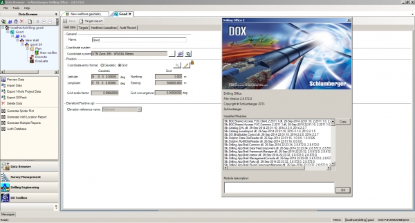
نرم افزارDrilling Office Xکه به اختصار به آنDOXمی گویند، مجموعه ای جامعی برای مهندسان حفاری می باشد که به کمک آن می توانند طراحی، مدیریت و ارزیابی در امر حفاری را به راحتی انجام دهند. این مجموعه شامل ماژول های اصلی Data Browser, Survey Management, Drilling Engineering, DD Toolboxمی باشد.رابط کاربری نرم افزار Drlling Office از نسخه2008.1تغییرات کسترده ای پیدا کرده است و نسبت به نسخه چهار نرم افزار محیطی آسان تر را برای کاربران ارائه می دهد. همان طور که در بالا اشاره شد، این نرم افزار دارای چهار بخش اصلی می باشد.
بررسی نرم افزار Drilling Office X - DOX:
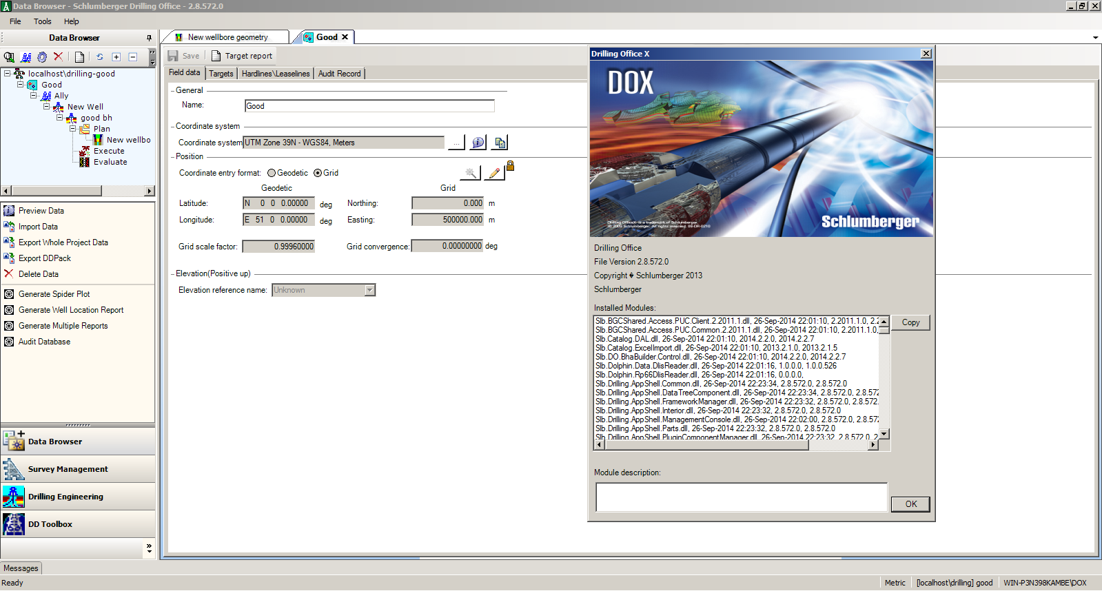
Data Browser gives you the power to create and manipulate drilling project databases. Drilling data are stored in a SQL database. As with the other Drilling Office applications, Data Browser can be installed in stand-alone mode or in conjunction with Survey Management and Drilling Engineering
Survey Management provides an intuitive method of creating, importing, and exporting proposals and surveys and the ability to perform anti-collision analysis. To create and work with proposals and surveys, a spreadsheet-oriented interface is provided. When you create a proposal, you provide a starting point (tie-in) and one or more segments, profiles, or targets. Segments can be hold or curve sections. Profiles contain multiple segments and are useful for quickly planning to targets within the database. To work with proposals and surveys created in previous version of Drilling Office, data can be imported from ASCII files
The Drilling Engineering module enables you to perform hydraulics, torque and drag, friction factor calibration, BHA sag, BHA Vibration, and BHA tendency analysis on a wellbore geometry. For each of these analysis types (except Fiction Factor Calibration), you can perform single-point and multiple-point computations for drilling, tripping, reaming or circulating operations
DD Toolbox is one of four modules in the DrillingOfficeX suite. It consolidates most of the operational needs of the field directional driller into one application that is part of DrillingOfficeX. DD Toolbox serves as the primary execution tool for the Schlumberger Drilling and Measurements unit (D&M) directional driller at the wellsite
تیم PetroTools آخرین نسخه این نرم افزار را برای شما ارائه می دهد. جهت تهیه نرم افزار با استفاده از منوی خرید با ما در تماس باشید
For buy software, Please contact us via buy menu