

 O-Sense
لرزه نگاری (4)
![]()
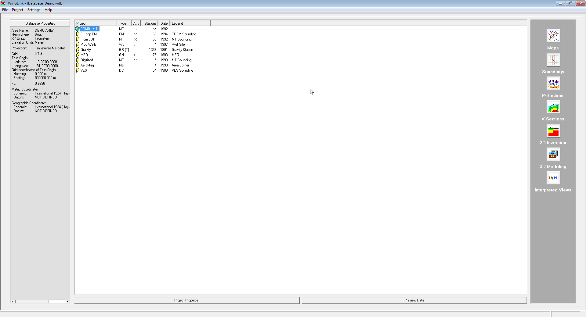
نرم افزار WinGLink یک نرم افزار مولتی دیسیپلین برای پردازش و ترکیب چندین دیسیپلین ژئوفیزیکی در یک مدل تفسیری بی همتا می باشد. این نرم افزار در گام اول بر روی اطلاعات مگنتوتلوریک (Magnetotelluric) و مدل سازیبر اساس استانداردهای جهانی فوکوس کرده است. WinGLink شامل پردازش و مدل سازی اطلاعات گراویته و مگنتیک و همچنین توانایی ارسال اطلاعات از چاه های عمودی و جهت دار بر روی نقشه و مقاطع عرضی جهت ساخت مدل ها می باشد. این نرم افزار از اینترفیسی آسان و ساده بر اساس ساخت دیتا بیس، تبدیل مختصات، دریافت خروجی و ورود اطلاعات و مدل ها و غیره تشکیل شده است.
بررسی نرم افزار WinGLink:
WinGLink is a multidisciplinary software program developed to process, interpret and integrate several geophysical disciplines in a unique interpretation model.
Primarily focused on Magnetotelluric data processing and modeling, for which it is the recognized worldwide standard, WinGLink includes processing and modeling applications for gravity and magnetic data, as well as the capability to post information from vertical or deviated wells on maps and cross-sections to add model constraints.
WinGLink uses a common graphic interface for database creation, project generation, coordinate conversion, data and model import/export, launch of applications. Each application includes dedicated features for each geophysical data type.
Follow the links below for details of additional WinGLink utilities.
Maps
A multidisciplinary software program developed to process, interpret and integrate several geophysical disciplines in a unique interpretation model.
Soundings
A multidisciplinary software program developed to process, interpret and integrate several geophysical disciplines in a unique interpretation model.
P-Sections
A multidisciplinary software program developed to process, interpret and integrate several geophysical disciplines in a unique interpretation model.
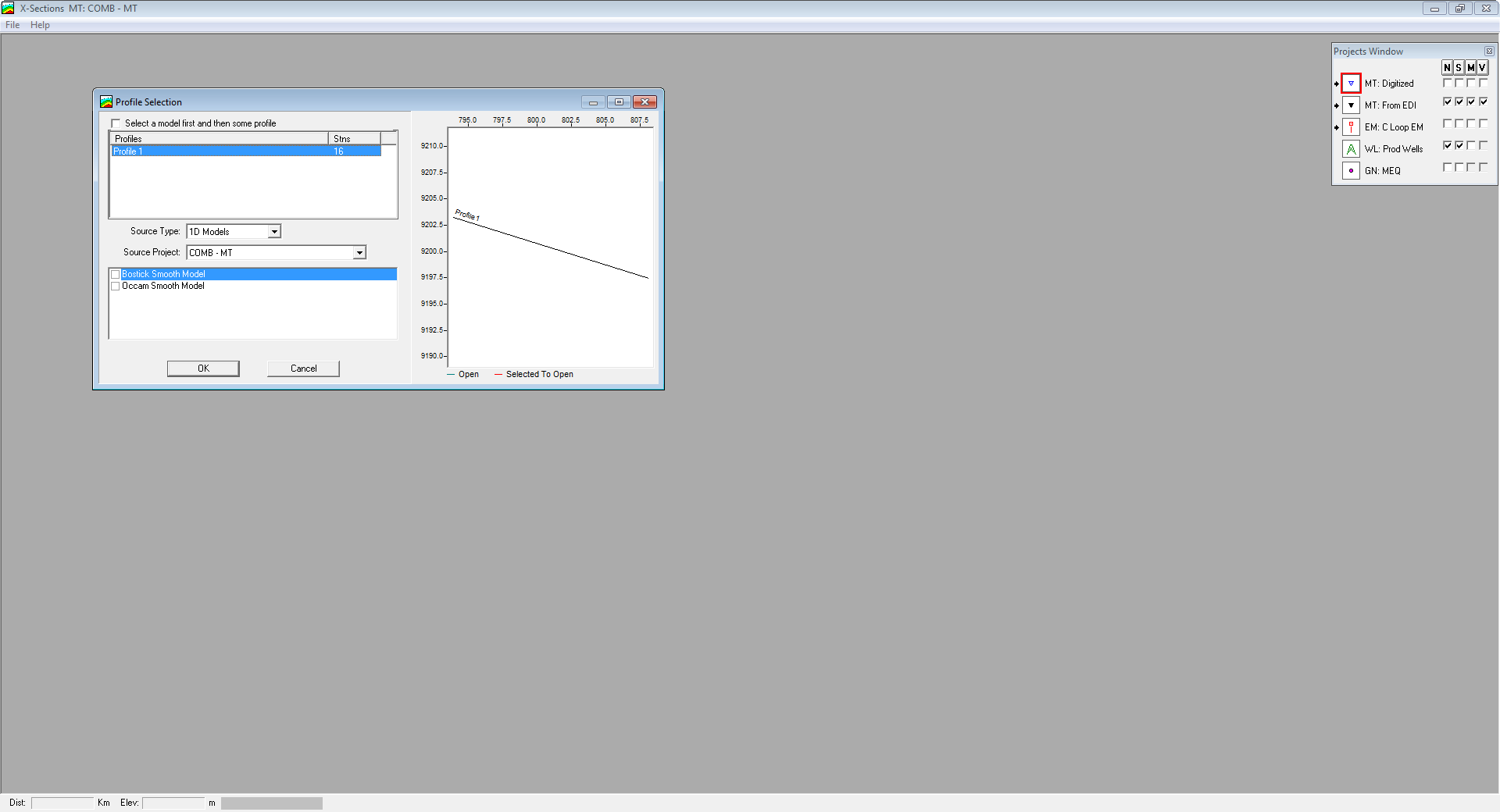
X-Sections
A multidisciplinary software program developed to process, interpret and integrate several geophysical disciplines in a unique interpretation model.
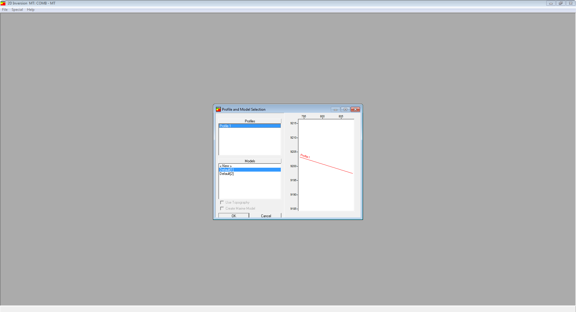
2D Inversion
A multidisciplinary software program developed to process, interpret and integrate several geophysical disciplines in a unique interpretation model.
3D Modeling
A multidisciplinary software program developed to process, interpret and integrate several geophysical disciplines in a unique interpretation model.
Interpreted Views
A multidisciplinary software program developed to process, interpret and integrate several geophysical disciplines in a unique interpretation model.
Tools
A multidisciplinary software program developed to process, interpret and integrate several geophysical disciplines in a unique interpretation model.
A WinGLink license supports diverse geophysical disciplines in an integrated modular package.
تیم PetroTools این نرم افزار را برای شما ارائه می دهد. جهت تهیه نرم افزار با استفاده از منوی خرید با ما در تماس باشید
For buy software, Please contact us via buy menu
ادامه مطلب...![]()
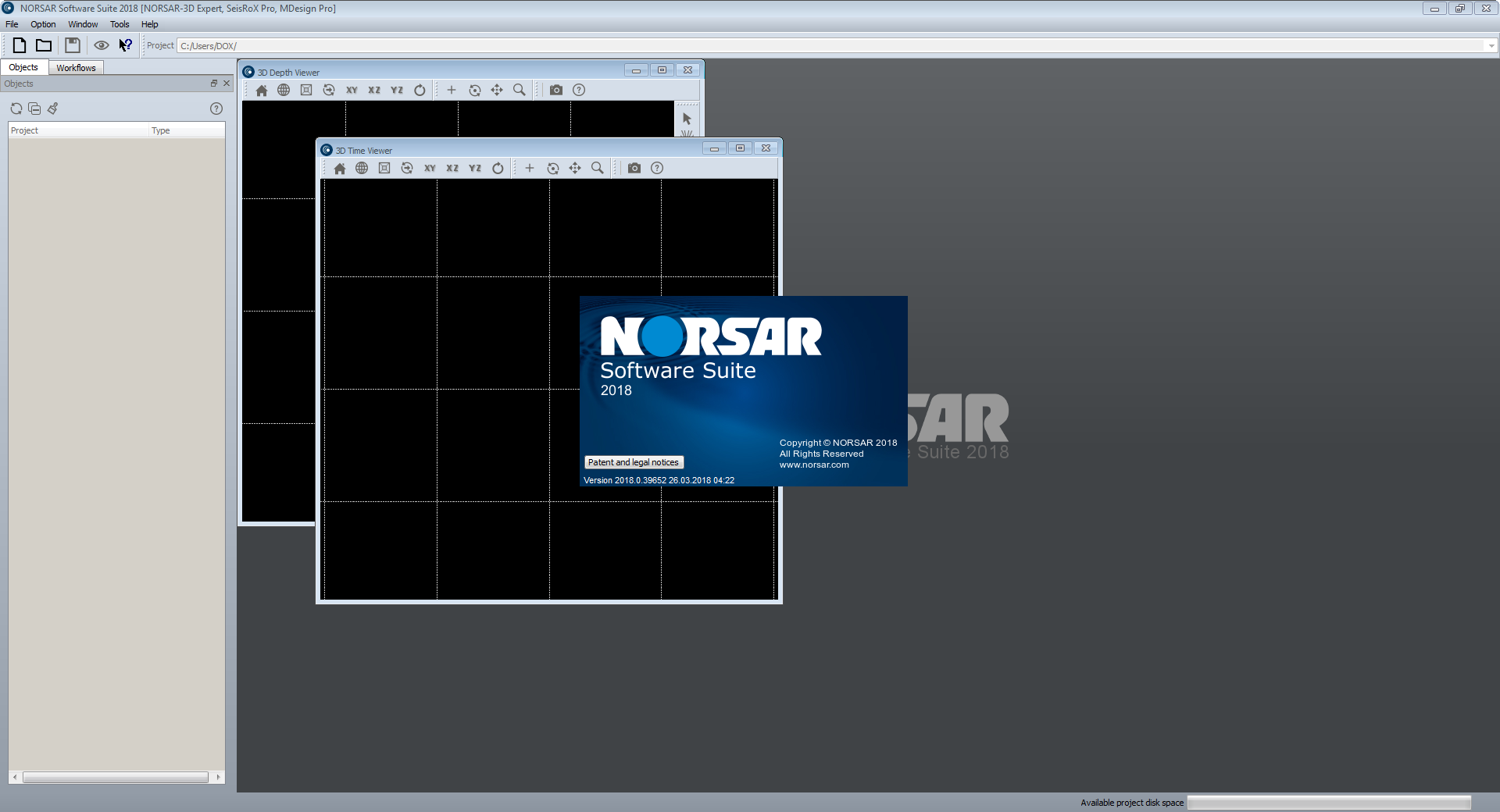
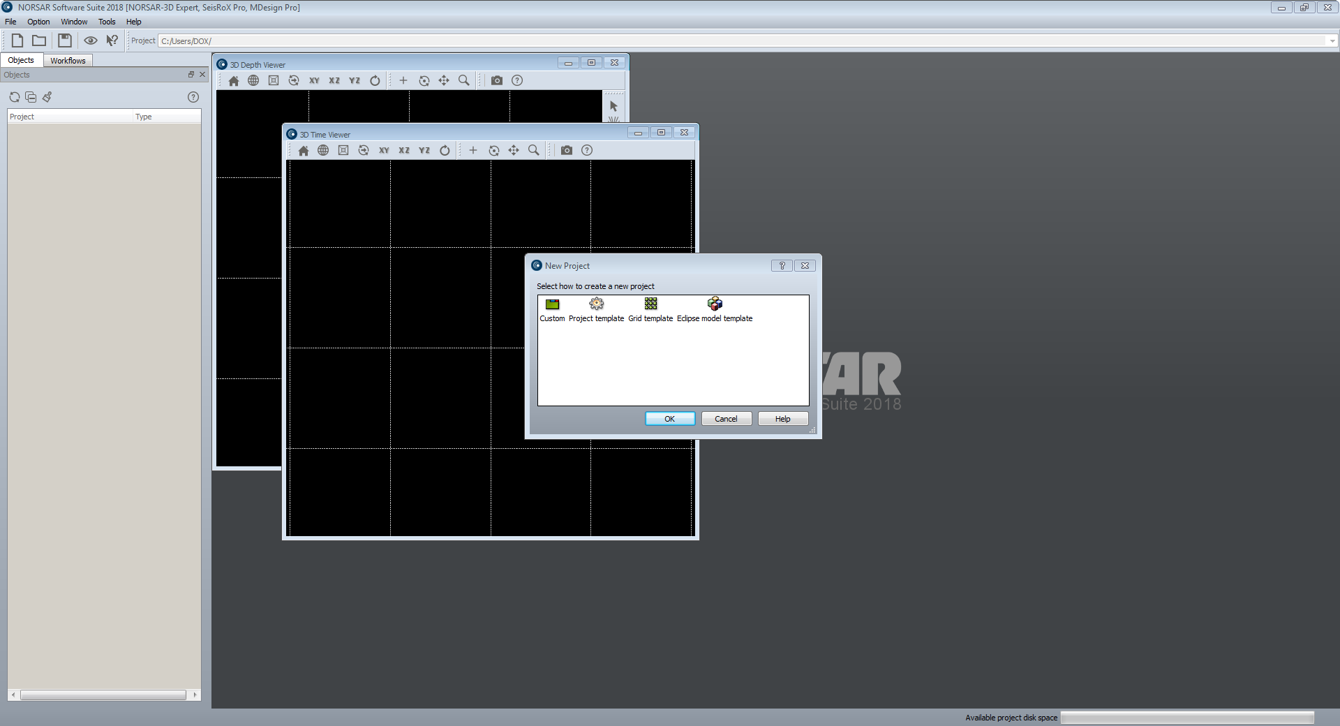
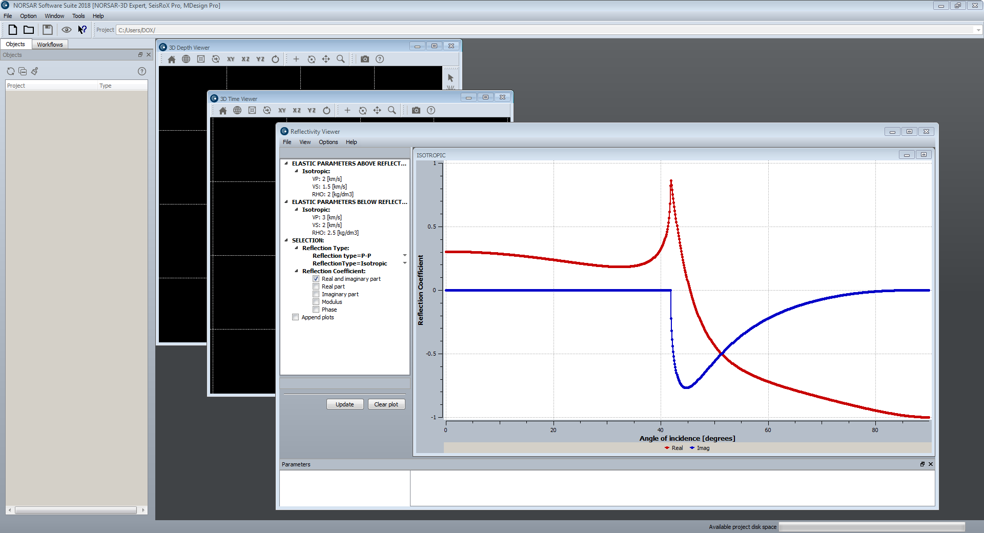
پکیج نرم افزاری NORSAR Software Suite محصول شرکت نروژی Norsar دارای ماژول های گوناگون برای مطالعات لرزه نگاری می باشد. این پکیج امکاناتی همچون Generate 3D models, Perform survey design and generation, ray modelling using the Wavefront, AVO/AVA analysis, Generate illumination maps, 3D and 2D seismic processing, full-field PSDM simulation را ارائه می دهد. این پکیچ شامل ماژول های NORSAR-3D, NORSAR-2D, SeisRoX, Mdesign می باشد.
بررسی نرم افزار Norsar Software Suite 2018:
NORSAR-3D
The new NORSAR-3D unveils a revolutionary new user interface for the NORSAR software. It makes the advanced and proven NORSAR-3D technology available in a completely new and simplified user experience.
The new NORSAR-3D is available in three different configurations: Basic, Pro and Expert. NORSAR-3D Basic is part of NORSAR-3D Pro and NORSAR-3D Pro is part of NORSAR-3D Expert. The NORSAR-3D Pro version is the upgrade version for existing customers. The new NORSAR-3D versions are backward compatible with older versions of NORSAR-3D project data.
NORSAR-3D includes functionality that enables you to:
-Import data (grid, trimesh, cube, survey, 2.5D models from N2D)
-Generate 3D models
-Perform survey design and generation
-Perform ray modelling using the Wavefront Construction method
-Generate seismograms
-Generate illumination maps (IMAP),
-Export data (grid, cube, trimesh, seismogram, illumination maps, event attributes)
NORSAR-2D
NORSAR-2D Ray-Modelling is the powerful, industry standard tool for 2D ray-trace modelling to understand seismic wave propagation.
NORSAR-2D Ray Modelling is a powerful tool to better understand your seismic data. You can evaluate your model by comparing synthetic results with the actual seismics or the interpretations. The model can be quickly updated to improve the match. Complicated tectonic structures and lateral or vertical velocity changes are modelled with great ease. NORSAR-2D includes depth conversion by means of ray tracing. Realistic interval velocities can be estimated from inversion of stacking velocities.
NORSAR-2D
-Is a powerful package for ray-based seismic modelling and depth conversion.
-Is flexible, fast, accurate and user-friendly.
-Is ideal for training, teaching, research, as well as industry-scale projects.
Some of the applications:
-Build and depth-convert 2D models.
-Plan and evaluate surveys.
-2D illumination studies.
-Ray path, event, and attribute analysis.
-AVO/AVA analysis.
-Understand reflections in seismic sections.
-Understand shadow zones in seismic sections.
-2D seismic processing support.
SeisRoX
SeisRoX is fully integrated in the NORSAR Software Suite platform and is available in two different configurations: Basic and Pro. SeisRoX Basic is part of SeisRoX Pro.
SeisRoX Basic
SeisRoX Basic is a flexible, efficient and easy-to-use seismic modelling software which rapidly simulates the seismic response of geological reservoir models including the effects of a complex 3D overburden and source-receiver illumination/resolution effects.
SeisRoX Basic focuses on a local scale and contains three types of workflows:
-Analytic workflows: Tools to do fast track modelling when background model or survey is not available or to study the effect of a user-designed PSDM filter
-Four different local-target workflows to do complete PSDM simulations with background model and survey
-Utility workflows for generating property cubes and time-convolution (1D)
SeisRoX Pro
SeisRoX Pro includes all the Basic functionality, and in addition it contains a full-field PSDM simulation workflow. With the Pro version, larger scale modelling is done by utilizing space-varying Point Spread Functions. Detailed studies of the space-varying PSF's can be done with the new PSF focusing map.
SeisRoX Pro also includes Rock Physics transformations to describe and calculate the relationship between geological properties and the effective (average) elastic and seismic properties to be used in the modelling. With the Rock Physics functionality the seismic response of rock property changes can be studied.
Simulating PSDM seismic images from reservoirs
SeisRoX™ is a software suite developed by NORSAR to efficiently model 3D PSDM (Prestack Depth Migration) seismic images at detailed reservoir scale.
Each tool can be used to provide innovative solutions to problems faced by the E&P scientist. However, the true benefit of SeisRoX is realised when the tools are integrated to provide the user with a robust, efficient and flexible workflow. In this format, the software guides the user from the generation of the rock physics model to the simulation and analysis of the 3D PSDM seismic image. This approach is particularly useful for investigating the seismic sensitivity of geological properties, seismic properties and reservoir geometry.
Capable of handling both large scale and small scale models, the effect of the overburden and survey characteristics can be incorporated while giving the user the functionality to assess the sensitivity to variations in rock properties and seismic parameters at the reservoir scale.
MDesign
The MDesign software helps operators, service providers and regulators to evaluate and optimize different sensor networks in order to maximize their cost-effectiveness.
The performance of an existing network can also be assessed and compared to results from recorded data. It is capable of using a full 3D model to provide the best possible analysis.
MDesign is applicable for both simple and complex monitoring scenarios: single or multi-well downhole networks, surface arrays, ocean bottom networks, or any combination of these.
The purpose of MDesign is performance evaluation of a proposed design. The effectiveness of a seismic network can thus be compared for different:
-Sensor distributions (short vs long string, single or multi well, downhole vs surface vs hybrid)
-Velocity models (1D or 3D)
-Noise levels (uniform or variable for each sensor)
-Sensor failure simulations (redundancy testing)
To determine the optimal sensor layout for a seismic monitoring campaign, MDesign aims to answer the following questions, important during network design:
-How cost-effective are different sensor layouts?
-What is the detection limit of a given network?
-How good are the event locations?
-Are regulatory requirements met by a given network?
-NORSAR also offers network design as a service, using our in-house expertise based on our well established network design and seismic monitoring experience.
MDesign is available as the latest NORSAR software package in the new NORSAR Software Suite framework.
Detectability
MDesign’s detectability analysis allows the user to find the minimum magnitude that can be detected for a given seismic network, throughout a model region. Multiple workflows can be created and tested for different sensor configurations. Different noise models can be generated, sensor failure can be simulated, and the effect of different input velocity models can be assessed.
For each network setup, parameters can be set for:
-Number of required sensors to be ‘triggered’
-Noise level at each sensor
-Attenuation
A 3D volume of detectability is generated that can be viewed interactively via cross-sections or isosurfaces of detectability. By analyzing maps of detectability the user can identify the network design to best meet the project goals. The detectability can also be evaluated to determine if regulatory requirements can be met. Furthermore, sensor failure and their impact on event detection can be quickly simulated.
Location uncertainty
MDesign’s location uncertainty analysis shows the variability of location precision throughout a model region. The location uncertainty is calculated for a specified event magnitude, where the detectability of the event at each sensor is considered during the computation. Similar to MDesign’s detectability analysis, multiple workflows can be created and tested for different sensor configurations, noise levels and velocity models.
The expected location uncertainty for various scenarios can be evaluated by its dependence on various parameters:
-Noise level (and SNR) at each sensor
-Errors for arrival-time picks & ray angles
-Event magnitude (i.e. triggered sensors)
The location uncertainty can be analysed via different components of uncertainty:
-Total (RMS) uncertainty
-Individual uncertainty directions (N, E, Z, minor, intermediate, major)
-“Ellipticity” (to evaluate uncertainty uniformity)
To increase understanding of the results and further improve a sensor network, MDesign allows for quick ray path analysis for all event locations through the complex model.
Focusing
MDesign’s focusing analysis shows the resolution for migration based location methodologies - typically used for dense surface arrays and ocean bottom networks. The focusing of seismic energy at a given location can be determined using Point Spread Functions, which incorporate the network layout, the velocity model, and the shape and frequency of a source wavelet, to compute the imaging response. By generating Point Spread Functions throughout a model region, the effectiveness of a given sensor configuration can be evaluated. This analysis allows the user to optimise a sensor layout by ensuring, sensor count, sensor spacing, line length and line spacing are all sufficient for a given target region.
For each network setup, parameters can be set for the source wavelet (frequency and shape), using predefined or user input functions. The spatial sampling of the Point Spread Functions can also be varied.
The resulting 3D volume of ‘focusing’ can be explored via cross-sections and with interactive ray-path plotting.
تیم PetroTools آخرین نسخه این نرم افزار را برای شما ارائه می دهد. جهت تهیه نرم افزار با استفاده از منوی خرید با ما در تماس باشید
For buy software, Please contact us via buy menu
ادامه مطلب...

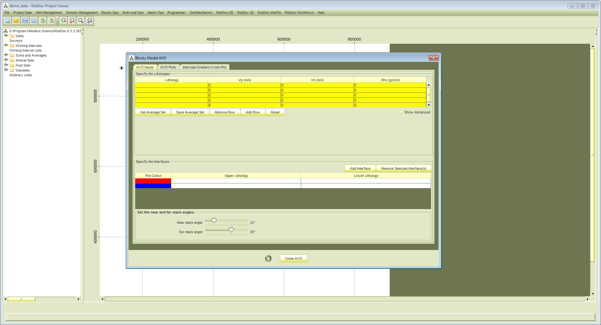
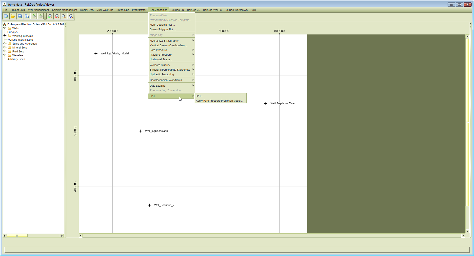
نرم افزارRokDocمحصولIkon Scienceبه عنوان یک نرم افزار اکتشاف کمی و توسعه ای شناخته می شود. RocDocیک پلتفرم قوی برای تفسیر کمی جامع(QI)با کاربرد آسان به حساب می آید و اولین گزینه انتخاب شرکت های بزرگ نفتی در پلتفرمQIمحسوب می شود (Survey Aupec 2012). این نرم افزار به متخصصان تفسیر امکان دسترسی به Rock Physics, Forward Modelling, Seismic Inversion, Geopressure, Advanced Quantitative Reservoir Analysis و Geomechanics را فراهم کرده است و همین امر باعث بالابردن قدرت تفسیر متخصصان شده است. هم اکنون این نرم افزار با کمک شرکت سازنده آن یعنیIkon Science و 170 شرکت نفتی بزرگ به سرعت در حال رشد و توسعه می باشد.
بررسی نرم افزار RokDoc:
RokDoc has been developed in collaboration with major oil companies and academic experts since 2001. Use it to analyse well and seismic data, determine value and apply quantitative methods to predict rock, fluid and pressure properties
With RokDoc seismic data can be integrated with log data and pressure data. RokDoc has unparalleled rock physics modelling capabilities and Rock Physics Model Templates. The tools can be used to identify porosity and many other types of geological variations, based on seismic and well data
Using the Rock Physics modules a 'basic' RokDoc user will easily make geological ‘sketches’ of a seismic interpretation and then determine if the synthetic matches the seismic. RokDoc makes it simple to perform all the usual fluid substitutions, variable contacts and pressure perturbations, etc
New to the RokDoc platform is the Attrimod multi-2D seismic forward modelling tool. Attrimod offers advanced multi-2D scenario modelling within the established RokDoc stratigraphic 2D modelling toolkit. With Attrimod the construction of hundreds of geological scenarios based on different layer configurations, rock properties and well data is automated, and workflows can be applied to modify the models based on rock physics concepts. Once models are constructed, attributes can be derived across all models simultaneously; attributes can be utilised as a database to maximise understanding of rock property variations in field appraisal, plus identify and characterise areas within the seismic data that match certain geological scenarios
The addition of the RokDoc Reservoir Characterisation modules to your tool kit, brings a range of sophisticated tools; convert existing inversion volumes into meaningful and accurate geological rock properties for prospect evaluation. The RokDoc 3D cross-plot allow users to integrate well, seismic and rock physics data and establish whether inversion results are consistent with forward models from well data. Define polygons to identify different AVO classes and facies in seismic data, or utilise the weighted stack cross-plotter to rotate and manipulate pairs of inversion volumes to reveal hidden lithology and fluid information
تیم PetroTools این نرم افزار را برای شما ارائه می دهد. جهت تهیه نرم افزار با استفاده از منوی خرید با ما در تماس باشید
For buy software, Please contact us via buy menu
ادامه مطلب...
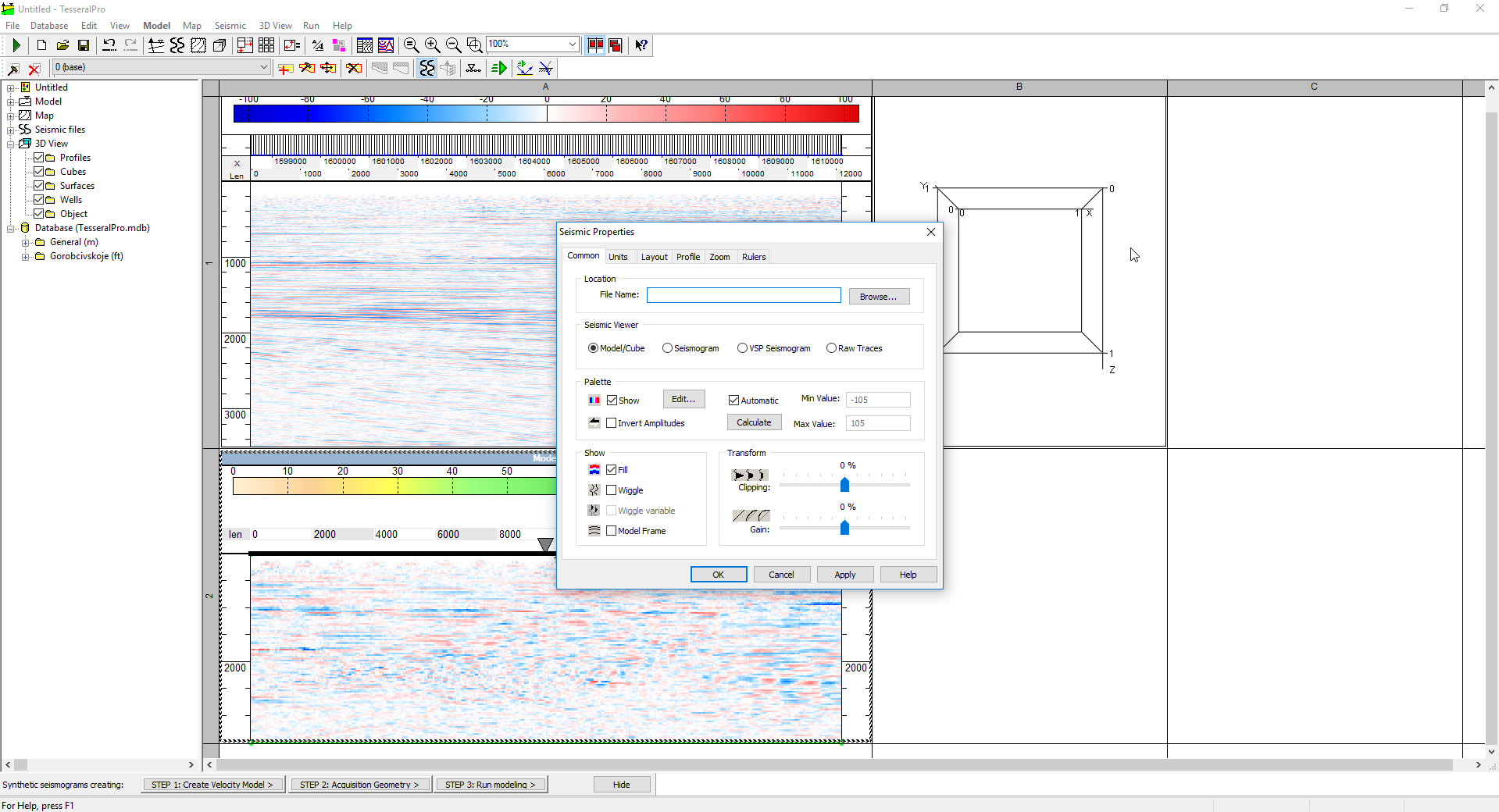
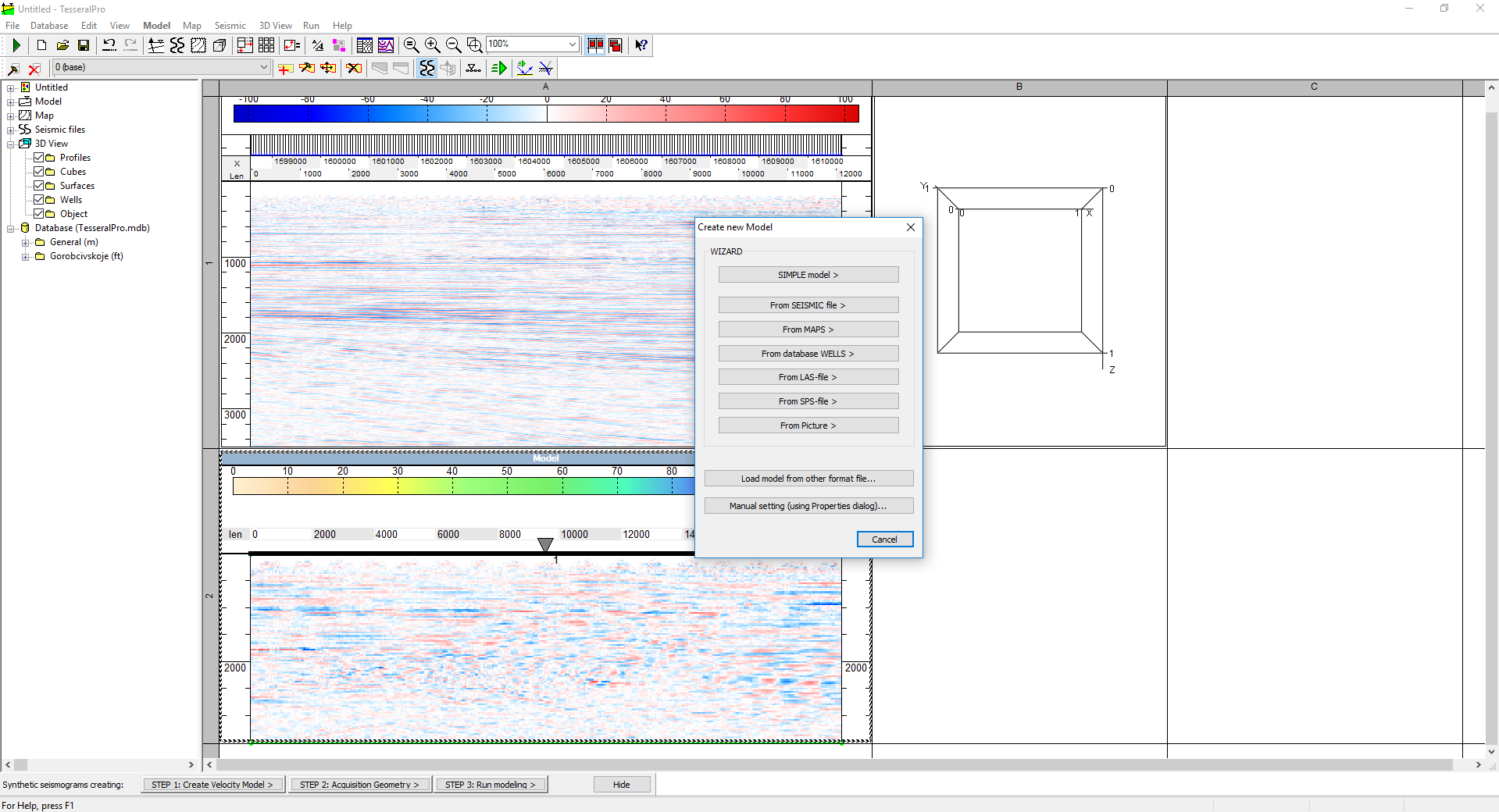
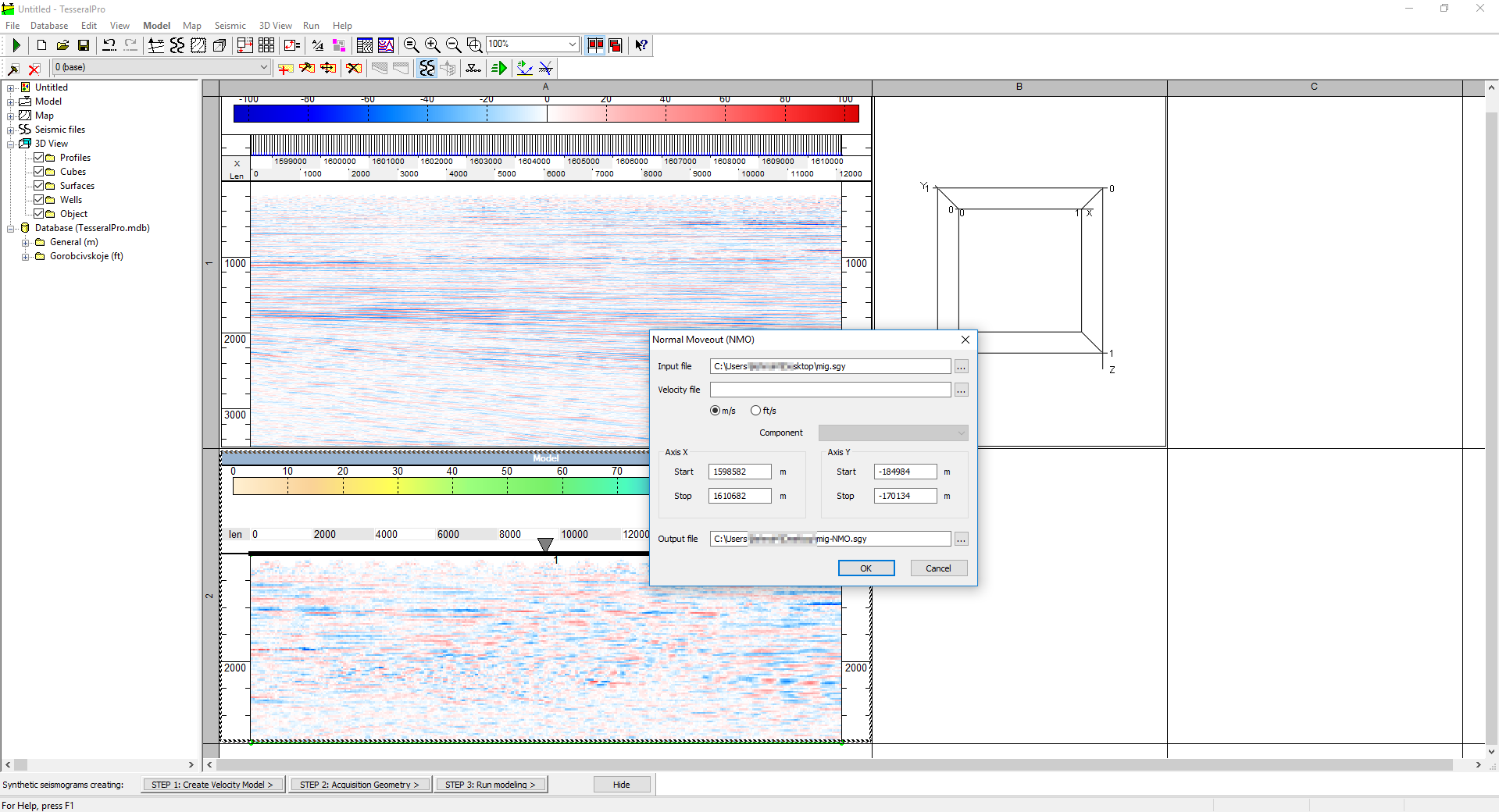
نرم افزار Tesseralمحصول Tesseral Technologies Inc نرم افزار بسیار دقیق جهت Full wave field modeling می باشد. بر اساس مدل دیجیتال یک ساختمان پیچیده زمین شناسی، supplementing blocksراه حل های متنوع مدل سازی برای برنامه ریزی، پردازش و تفسیر لرزه ای را ارائه می دهند. این نرم افزار تمامیWorkflowهای زمین شناسی و ژئوفیزیک از محیط های آکادمیک دانشگاهی تا مرحله اکتشافات لرزه نگاری را در خود جای داده است. نرم افزار Tesseral Proبر اساس نرم افزار دیگر این شرکت یعنی Tesseral 2Dتوسعه یافته است و دارای ابزارهای اضافی در Ray Tracingمی باشد که برای تجزیه و تحلیل تعاملی و بررسی مدل های عمق - سرعت میدان های نفت و گاز با استفاده از دیتا بیس زمین شناسی - ژئوفیزیک ایجاد شده است.
بررسی نرم افزار Tesseral 3D:
Tesseral Technologies Inc. develops commercial software packages for highly accurate wave field modeling. Based on a digital model of a complex solid body, the supplementing blocks provide various modeling solutions for seismic survey planning, processing and interpretation
Our software is suitable for all kinds of geological-geophysical workflows ranging from academic research up to exploration geophysics. It also can be used as a learning tool, for preparing presentations, and for estimation on geophysical projects
We are continually developing and supporting new features of our software products. Training and consulting for software users is provided onsite or via our internet conferencing capabilities. Valued feedback from our client base since 2001 has been instrumental in the continuing improvement of our software. Modeling Services are available
تیم PetroTools آخرین نسخه این نرم افزار را برای شما ارائه می دهد. جهت تهیه نرم افزار با استفاده از منوی خرید با ما در تماس باشید
For buy software, Please contact us via buy menu
ادامه مطلب...